Bryan Norcross: Can’t rule out impacts in the Caribbean islands next week
FOX Weather Hurricane Specialist Bryan Norcross joins Weather Command to talk about the latest area to watch in the Atlantic and the two hurricanes in the Pacific.
Updated at 9:30 a.m. ET on Wednesday, Sept. 3, 2025
The National Hurricane Center has increased the odds that the eastern Atlantic tropical disturbance will develop into a tropical depression or Tropical Storm Gabrielle. They put the chances of development over the next week in the high category.
The various computer forecasts are all over the place. Some models analyze the atmospheric conditions ahead of the disturbance as reasonably conducive to development. Others predict that development will be slow due to dust and dry air and hostile upper-level winds from an upper-level low pressure system. There is also the question of exactly how strong the blocking high to the north is going to be.
A rule of forecasting is that predictions for systems that are disorganized, just developing or moving slowly are always subject to large errors and likely to change. Every one of those adjectives fits this disturbance, so for now, we have to be open to a wide range of possibilities.
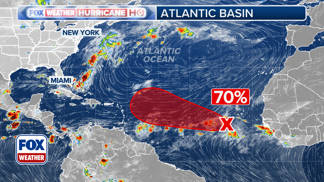
This graphic provides an overview of the tropical Atlantic Basin.
(FOX Weather)
If the disturbance finds a pocket of atmosphere that allows it to spin up and intensify into Tropical Storm Gabrielle relatively soon, the consensus of the various computer forecasts is that the system will veer to the north before reaching the islands. That’s not guaranteed, of course, but it’s logical.
If the system stays weaker longer, it’s more likely to track closer to the northeastern Caribbean. That would open up a lot of possibilities. The atmospheric pattern in the vicinity of the Caribbean looks like it will be more conducive for development next week. But there are a lot of moving parts.
At FOX Weather, we produce an exclusive Tropical Threat analysis based on the European, U.S. GFS and Google DeepMind AI models output that shows the reasonable range of possibilities for the system’s track and chance of developing into at least a tropical depression.
Notice that the odds of any singular outcome are low. The light blue indicates 10%. Also notice the two arms that stick up to the north. That shows where the models are saying there’s a chance the system will strengthen early and quickly turn north.
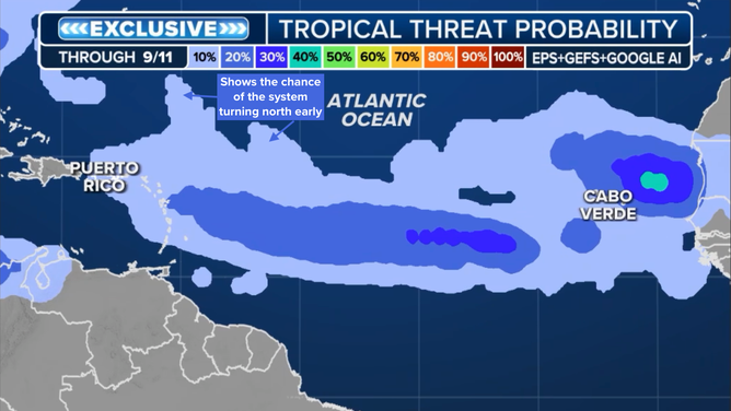
Tropical Threat analysis.
(FOX Weather)
The possible turn to the north will only happen if the big dip in the jet stream that is forecast to be over the eastern part of the U.S. next week can grab the system. If it gets reasonably strong, the turn north is more likely to happen. On the other hand, if the disturbance stays weak too long, it’s more likely to track farther west. But all of that is more than a week away – too far to do anything more than speculate about.
Everything is in slow motion here, so there’s nothing to do but wait and observe. On the current schedule, the system won’t even be in the vicinity of the islands until seven or eight days from now. Obviously, a lot can happen in the meantime.
Interestingly, nothing else seems imminent in the Atlantic, although obviously, we can expect more disturbances moving off Africa this month.
In the Pacific
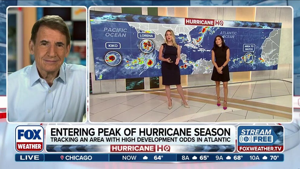
Hurricane Lorena is forecast to weaken over the cool ocean water near Baja California Sur. The current forecast is for it to make landfall about Thursday well north of Cabo San Lucas as a tropical storm. Everyone there should stay well-informed.
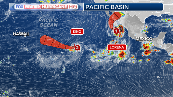
Two active hurricanes in the Pacific.
(FOX Weather)
Hurricane Kiko is still heading west in the general direction of Hawaii. The strong consensus is that Kiko will weaken dramatically before it reaches the islands early to mid-next week. A noticeable moisture surge is still possible, however, especially on the Big Island. Everybody should stay informed about Kiko’s progress.
Source link
editor's pick
latest video
Sports News To You
Subscribe to receive daily sports scores, hot takes, and breaking news!