Plains, Florida face continued flood threat as millions head home after Labor Day

Rounds of rai and thunderstorms is putting parts of the Plains and Florida at risk of seeing some flooding on Monday. FOX Weather Meteorologists Bob Van Dillen and Marissa Torres have the latest forecast on Sept. 1, 2025.
Tens of millions of people are about to hit the road and head home after the Labor Day holiday weekend, but some of those trips could see delays as more rounds of relentless rain and thunderstorms are increasing the flood threat across portions of the Plains, as well as in Florida.

A dramatic timelapse video recorded in Lubbock, Texas, shows an ominous supercell thunderstorm descending upon the Texas Tech game on Saturday, Aug. 30.
Labor Day is often seen as the last official weekend of summer, making the transition from hot days to the first hints of a fall-like feel. In fact, some parts of the Upper Midwest have already seen their first Frost Advisories, and trees are even starting to change colors in Alaska.
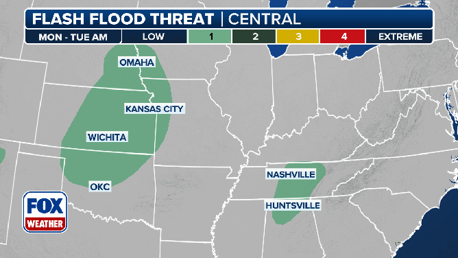
This animated image shows the flash flood threat on Monday, Sept. 1, 2025.
(FOX Weather)
Below-average temperatures will persist across a large chunk of the U.S., but where temperatures aren’t making headlines, a flash flood threat will persist.
Moisture levels are expected to remain high along and ahead of a cold front that’s been sweeping across the U.S. for one last day after a stormy weekend.
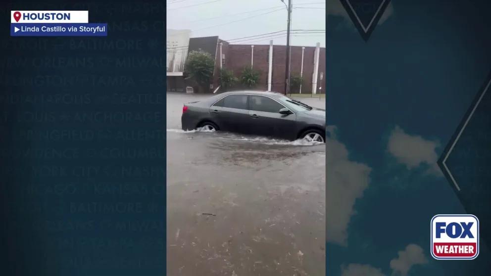
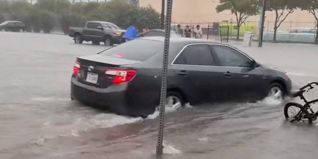
A video recorded in Houston shows a road that was turned into a river during flash flooding on Sunday, Aug. 31, 2025.
Storms will be hit-or-miss, so it won’t be a total washout for everyone on Monday. However, the FOX Forecast Center said storms that do develop could drop heavy rain in a short period of time, leading to areas of flooding.
Most locations will see low rain totals, but some spots in the Plains could pick up 1-2 inches of rain.
In addition to that front, a weaker area of low pressure is moving out of the Plains.
Major cities like Kansas City and Nashville will still be at risk of seeing some heavier rain, but drier conditions are expected by mid- to late-week.
NOAA’s Weather Prediction Center (WPC) highlighted areas of the central and northern Plains, as well as parts of the Tennessee Valley, in a Level 1 out of 4 flash flood threat on Monday.
DOWNLOAD THE FREE FOX WEATHER APP

Heavy rain in Dallas, Texas, causes flooded roads for travelers on Saturday.
Parts of southern New Mexico and Arizona in the Southwest, as well as portions of western and southern Texas, have also been placed in a Level 1 out of 4 flash flood threat.
Flood Watches had been posted for portions of Texas, including Austin, San Antonio and Kerrville – the site of the catastrophic and deadly flash flooding event that took place on July 4. However, those have since been expired.
Storms, heavy rain continue to pound parts of Florida

(FOX Weather)
Florida has also been stuck under a multiday flash flood and thunderstorm threat, and that won’t be changing much this week.
The stalled-out cold front is continuing to slide farther to the south and east across the Sunshine State. And with both coasts of Florida seeing drought conditions, the rain is much-needed.
Through Monday, an area of low pressure will slide along the nearly stationary cold front across Florida and the Southeast. And with a strong dip in the jet stream, tropical development is unlikely.

(FOX Weather)
Nevertheless, the added moisture along the front is boosting rainfall totals.
Even as this first front breaks down, a second front will start to move through and will likely stick around until Thursday or Friday.
The WPC placed most of the Florida Peninsula at a Level 1 out of 4 flash flood risk this week.
Source link
editor's pick
latest video
Sports News To You
Subscribe to receive daily sports scores, hot takes, and breaking news!