FOX Weather Hurricane Specialist Bryan Norcross breaks down Erin’s track
Tropical Storm Erin is expected to intensify into a hurricane by Friday and turn north of the Leeward Islands. FOX Weather Hurricane Specialist Bryan Norcross gives his expert analysis on Erin’s future impacts as well as new tropical trouble brewing in the Gulf.
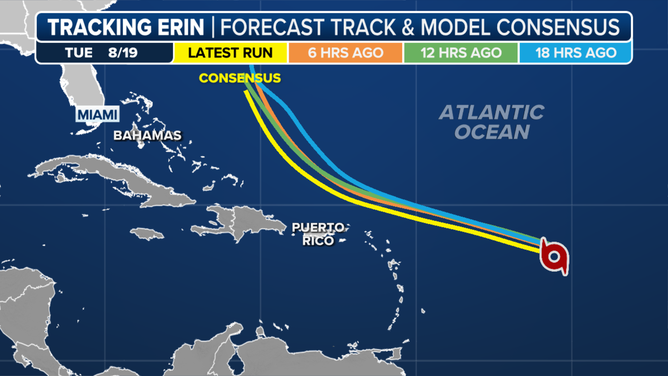
Tropical Storm Erin is expected to strengthen into a hurricane by Friday, with its most likely track keeping its center well offshore of the U.S. East Coast while producing coastal impacts, FOX Weather Hurricane Specialist Bryan Norcross said during a live question-and-answer segment.
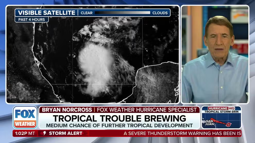
On Thursday, Norcross addressed viewer concerns about both Erin and a separate system in the Gulf of America, which was given a 40% chance of development by the National Hurricane Center.
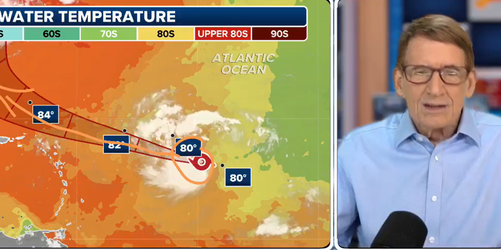
Within the system known as Invest 98L over the southwestern Gulf, Norcross said Hurricane Hunter aircraft had found signs of weak rotation, with peak winds around 30 mph in one rain band, but the circulation wasn’t significant.
Tracking Invest 98L
(FOX Weather)
The disturbance is moving toward northern Mexico and southern Texas, bringing the potential for heavy rain and localized flooding into the weekend.
Meanwhile, Erin’s forecast cone shows the future hurricane curving between Bermuda and Cape Hatteras, North Carolina, next week.
TRACK TROPICAL STORM ERIN: LIVE MAPS, FORECAST CONE, SPAGHETTI PLOTS AND ALERTS
The NHC expects Erin to strengthen rapidly over warmer water, potentially reaching Category 3 or 4 intensity, all while staying safely offshore.
Norcross said Puerto Rico and nearby islands could see tropical-storm-force winds, squalls and isolated power outages over the weekend as the storm’s outer bands pass.
Along the U.S. East Coast, Norcross stressed that impacts are likely even if Erin stays well offshore. Long-period swells and dangerous rip currents could affect beaches from the Southeast to New England, with possible beach erosion and localized coastal flooding.
North Carolina’s Outer Banks, particularly Highway 12, could be vulnerable depending on the hurricane‘s overall size and proximity.
“We’ve had issues with Highway 12 being washed out and so forth, and I’m not saying that’s going to happen, but that is a possibility depending on how much energy we get,” said Norcross.
Tracking Tropical Storm Erin
(FOX Weather)
The hurricane expert said the chance of Erin unexpectedly turning westward toward Florida or the Southeast is “in the single percentage” given the accuracy of seasoned forecasters and computer models.
While some historical hurricanes have deviated from their forecast tracks, Norcross noted that today’s computer models are significantly more accurate than even a decade or two ago.
Tracking Tropical Storm Erin
(FOX Weather)
For those with upcoming travel, including cruises from Miami and Puerto Rico, Norcross said cruise lines monitor storms closely and may adjust itineraries to avoid dangerous conditions.
Norcross emphasized that the most likely scenario keeps Erin’s core offshore, with Bermuda potentially seeing greater direct impacts than the mainland U.S.
“In any case, in Bermuda, they have to keep an eye on this,” Norcross stated. “A big hurricane puts a lot of energy out there, pushing ocean water in big, long-period swells.”
Source link
editor's pick
latest video
Sports News To You
Subscribe to receive daily sports scores, hot takes, and breaking news!