Southeast braces for more heavy rainfall, flooding threat
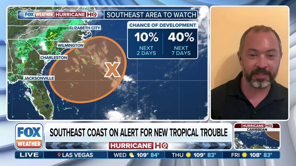
Stephen Mullens, Meteorology Professor at the University of Florida, spoke about the chances for tropical development off the Southeast coast by the end of this week.
SAVANNAH, Ga. – A stalled frontal boundary draped across the Southeast, combined with developing areas of low pressure, is setting the stage for several more days of heavy rainfall from the Interstate 10 corridor northward through Georgia and the Carolinas.
According to the FOX Forecast Center, the potential for daily rounds of rain and thunderstorms will persist through the weekend, with some areas could receive double-digit rainfall totals.
Flood Watches remain in effect for multiple counties across the region, particularly in areas that have already experienced significant rainfall over the past week.

(FOX Weather)
These watches can be upgraded to Flood Warnings if storms repeatedly pass over the same locations, swamping already saturated ground and overwhelming drainage systems.
Cities and communities in the greatest-risk zone include Tallahassee and Jacksonville in Florida, Charleston and Myrtle Beach in South Carolina, and Wilmington, North Carolina.
515-MILE ‘MEGAFLASH’ FROM TEXAS TO MISSOURI CONFIRMED AS WORLD’S LONGEST LIGHTNING BOLT

(FOX Weather)
All eyes are also on the western Atlantic, where a disorganized tropical disturbance is being monitored for potential development.
The National Hurricane Center currently gives the system a medium chance of forming into a tropical depression or tropical storm over the next few days.
However, the FOX Forecast Center stresses that the absence of a named storm does not change the threat, with significant chances of rainfall each and every day.
Hurricane Hunter aircraft remain on standby to investigate the disturbance if needed.
As of midweek, rapid tropical development was not expected to occur, but forecasters remain watchful for any signs of organization as the system slowly drifts offshore.
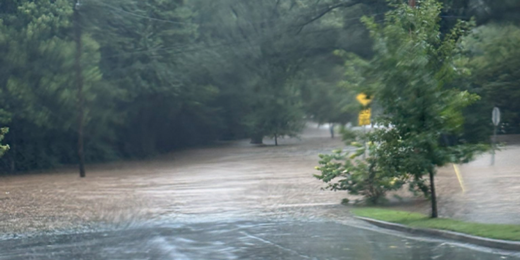
Flooding has already been reported outside of Charlotte, North Carolina, with an estimated 5 to 8 inches of rain that fell on Tuesday, prompting water rescues.
Similar flooding issues were also reported in parts of Alabama and Georgia, where saturated soils and slow-moving storms led to hazardous conditions.

(FOX Weather)
SHIPPING INDUSTRY REPORTS MORE THAN 500 CONTAINERS LOST AT SEA DURING PAST YEAR
In addition to the flooding concerns, isolated severe thunderstorms are possible through the remainder of the week.
Damaging wind gusts and frequent lightning may accompany stronger cells, and they’ll tend to move rather slowly.
Coastal impacts are also expected to increase, even in the absence of a named tropical system.
Rough surf and an elevated risk of rip currents will affect beaches from Florida to the Carolinas, posing a danger to swimmers.
A consequence of the persistent cloud cover and rain will be cooler daytime temperatures.
Several observation sites across the Southeast have reported near-record-low high temperatures, with typical readings well into 80s and 90s, during the final month of meteorological summer.
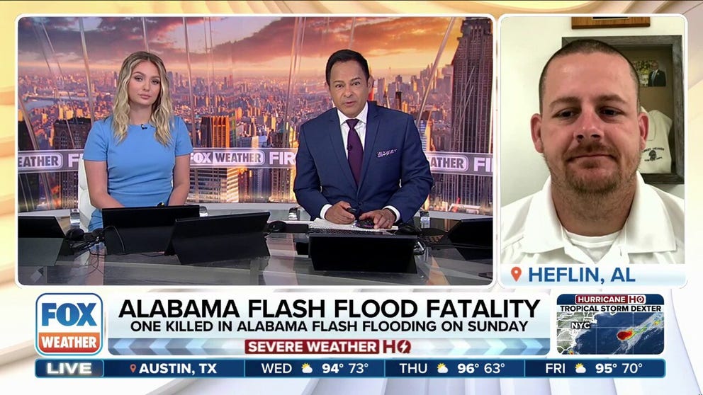
A stalled cold front brought deadly flooding to part of Alabama. According to the Cleburne County Sheriff’s Office, one person was killed and others needed to be rescued after floodwaters rushed over roads and washed away vehicles. The Turkey Heaven Volunteer Fire Department said emergency crews were dispatched twice in the span of about two hours to help those who attempted to cross water-covered roads. Patrick Nolen, Fire Chief of Turkey Heaven Volunteer Fire Department spoke with FOX Weather.
Source link
editor's pick
latest video
Sports News To You
Subscribe to receive daily sports scores, hot takes, and breaking news!