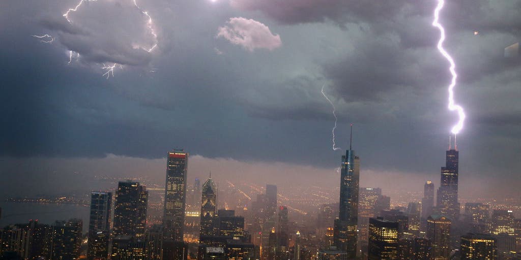
Chicago, Detroit amid nearly 40 million covered in Saturday severe weather threat

The FOX Forecast Center is monitoring a large swath of the Midwest and Great Lakes region for the potential development of severe thunderstorms over the next 24 hours.
DES MOINES, Iowa – The FOX Forecast Center is monitoring a large swath of the Midwest and Great Lakes region for the potential development of severe thunderstorms over the next 24 hours, with damaging winds, hail and even a few tornadoes as a mesoscale convective system develops and works east-southeast.
NOAA’s Storm Prediction Center has placed a four-state region under a slight, or Level 2 of 5, risk for severe storms – a designation that could be upgraded if meteorologists see a larger severe weather outbreak on the horizon.

(FOX Weather)
Once the convective system forms, it is expected to advance eastward, putting cities including Des Moines, Chicago and Indianapolis in the potential path, which expands the risk for organized severe storms from just four states to nearly a dozen.
A key question, forecasters say, is how long the storm complex can sustain itself, with communities closer to the initial development point expected to face the greatest risk.

(FOX Weather)
WHAT IS A MESOSCALE CONVECTIVE SYSTEM?
If the system maintains its strength and travels more than 250 miles while producing a swath of damaging hurricane-force winds, it would meet the definition of a derecho.
Derecho events are relatively rare, with fewer than a handful occurring each year.
About 70% of derechos take place between May and August, according to historical data from NOAA.
These events often follow the western or northern periphery of a strong ridge of high pressure over the mid-section of the country.
One of the most destructive derechos in history struck the Midwest during the summer of 2020.
During the event, wind gusts reached 140 mph and caused more than $7.5 billion in damage across several states.
The Fox Forecast Center said the evolution of the storms will depend on how the MCS develops and moves.
While some communities, especially on the eastern end of the threat zone, may miss out on the complex of organized storms, enough instability will likely be untapped for additional scattered showers and thunderstorms to develop down the line.
This would likely involve cities such as Detroit, Erie, Cleveland and Fort Wayne.
The later storms would mainly bring heavy rain and be more isolated, as opposed to the more organized, damaging complex of storms expected earlier during the day.
Forecasters advised residents in the risk area to monitor the weather outlook closely, as precautions such as staying away from windows and seeking a substantial structure may be necessary ahead of the stronger storms.
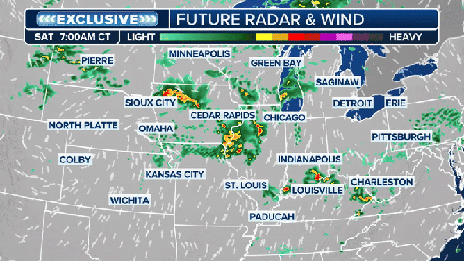
Saturday future forecast animation
(FOX Weather)
Source link
editor's pick
latest video
Sports News To You
Subscribe to receive daily sports scores, hot takes, and breaking news!