Heavy rain to soak Florida ahead of potential tropical threat for the Gulf Coast brewing this week
Tropical moisture has started to surge into Florida today, setting the stage for several days of widespread rain. As the system shifts into the eastern Gulf by Tuesday and Wednesday, a weak surface low could try to develop. The NHC is now highlighting this feature giving it a 30% chance of tropical development over the next seven days and 10% over the next 2 days.
TAMPA, Fla. – A large area of disturbed weather off the Southeast coast will move west over Florida and bring periods of heavy rain and a flash flood threat to the Sunshine State beginning Monday. This system is infused with lots of tropical moisture and has the potential to become a tropical depression, as it tracks into the Gulf this week.
According to the FOX Forecast Center, the tropical moisture will enhance the intensity of storms, meaning they could be capable of producing 1–3 inches of rain per hour.
In addition, these storms will be slow-moving over Florida on Monday, leading NOAA’s Weather Prediction Center to issue a Level 2 out of 4 flash flood threat covering most of central and South Florida.
BRYAN NORCROSS: WATCHING FOR FLORIDA FLOODING, THEN CHANCE OF DEVELOPMENT IN GULF
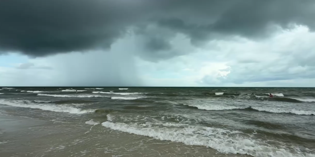
Thunderstorms slammed Palm Coast and other parts of Florida’s East Coast on Sunday ahead of more rain this week.
At least 2-3 inches of rain are expected to fall all along Florida’s Gulf Coast and even many inland areas through Thursday. Some areas could see localized rainfall accumulations of 3-5 inches.
In addition, NOAA’s Storm Prediction Center has issued a Level 1 out of 5 risk for severe thunderstorms covering the entire state Monday. The risk highlights the potential for damaging wind gusts associated with these storms.
Heavy rain is also expected along the Gulf Coast from Alabama to Louisiana, including New Orleans, through the week.

(FOX Weather)
The flash flood threat will wane in Florida as the week progresses.
A Level 2 out of 4 threat covers Orlando, Tampa Bay, Fort Myers and Miami through Tuesday.

(FOX Weather)
Potential tropical development in Gulf this week
Several Hurricane Hunter flights from NOAA are set to take off Tuesday, which will fly into these storms and gather data about their strength.
While conditions in the Atlantic basin are hostile to tropical development, conditions in the Gulf, including warm water temperatures, could be conducive for the formation of at least a tropical depression sometime this week.
Currently, forecast models don’t currently point to the formation of a strong tropical system, but a few individual models hint at the possibility of development in the Gulf.
Whether that happens will depend on key factors like the strength of hostile winds and how long the system lingers over warm water as opposed to forming close to land where it would be weaker.
“The opportunity to develop into something more organized beyond a depression is going to be a little more challenging,” said FOX Weather Meteorologist Marissa Torres.
The National Hurricane Center is giving this area to watch a low chance of developing into a tropical depression over the next two days and a slightly higher chance of development over the next week.
Eventually, the system will move into the northern Gulf Coast, likely near Louisiana or Mississippi sometime Wednesday.

(FOX Weather)
Regardless of development, this system could still bring heavy rain to coastal Mississippi, Alabama, Louisiana and even some inland parts of those states.
“There is not a good consensus on how quickly the system will move past the Alabama, Mississippi, Louisiana coastal sections this weekend,” said FOX Weather Hurricane Specialist Bryan Norcross.
FOX Weather Correspondent Robert Ray will be live in Florida later Monday for full coverage of this system. Be sure to download the FOX Weather App or your favorite connected TV device.
Source link
editor's pick
latest video
Sports News To You
Subscribe to receive daily sports scores, hot takes, and breaking news!


