Today’s top weather news: Potential tropical trouble brews as heavy rain lashes Southeast coast
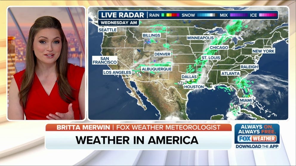
FOX Weather has you covered with the breaking forecasts and weather news headlines for your Weather in America on Wednesday, June 4, 2025. Get the latest from FOX Weather Meteorologist Britta Merwin.
Welcome to the Daily Weather Update from FOX Weather. It’s Wednesday, June 4, 2025. Start your day with everything you need to know about today’s weather. You can also get a quick briefing of national, regional and local weather whenever you like with the FOX Weather Update podcast.
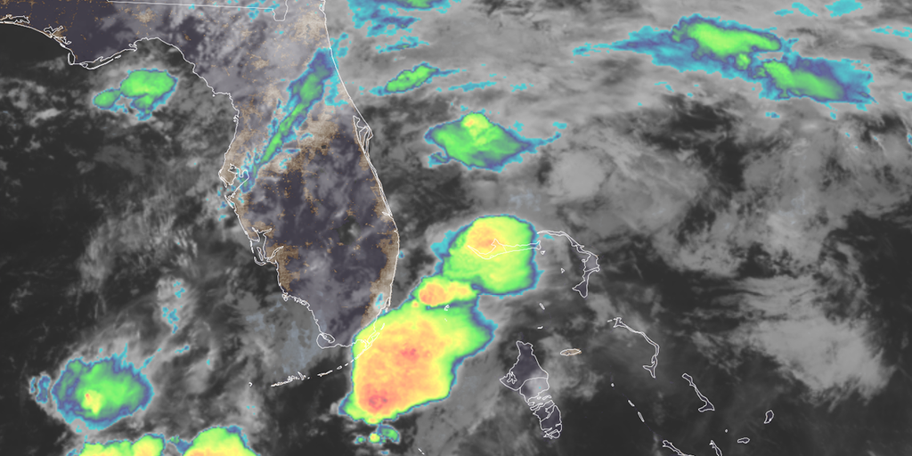
Potential tropical threat monitored off Carolinas as heavy rain lashes Southeast coast
A low-pressure system is brewing off the Southeast coast, threatening heavy rain and flash flooding in Georgia, South Carolina and North Carolina. The National Hurricane Center is keeping a close eye on the system for a low chance of tropical development.
This system, which already dumped over 6 inches of rain on Miami earlier this week, is expected to track northward along the southeastern U.S. coastline starting Wednesday afternoon.
The FOX Forecast Center is monitoring its path, noting that its proximity to land will influence the likelihood of it developing into a tropical depression or tropical storm.

(FOX Weather)
Flash Flood Emergency strikes Kansas with water rescues around Wichita
Strong to severe thunderstorms swept through central Kansas on Tuesday, triggering life-threatening flooding in and around eastern Wichita.
The National Weather Service office that covers the Wichita area issued a Flash Flood Emergency – the highest level of flood alert – for more than 200,000 residents after rainfall rates reached between 1-3 inches per hour.
Within the Flash Flood Emergency zone, storm totals reached nearly 7 inches of rainfall, which overwhelmed drainage systems and transformed roadways into rivers. The heaviest rainfall occurred east of Interstate 135, where multiple water rescues were reported throughout the afternoon.
Florida could see ‘dirty rain’ as large Saharan dust plume arrives in Southeast this week
A large wave of Saharan dust making its way across the Atlantic Basin is forecast to arrive in the U.S. later this week, impacting the Southeast with hazy skies and “dirty rain.”
NOAA estimates that more than 180 million tons of dust leave the African continent every year, and the extremely dry air reduces thunderstorm activity and tropical cyclone formation.
Saharan dust has taken over nearly the entire Atlantic Basin, according to NOAA satellites. One of the larger waves of concentrated dust approached the Caribbean on Monday. By Thursday, this thick plume is forecast to enter the Gulf of America, over the Florida Keys and cover much of the Sunshine State. Another round of dust will move in along the northern Gulf Coast by Friday and head into the Southeast.
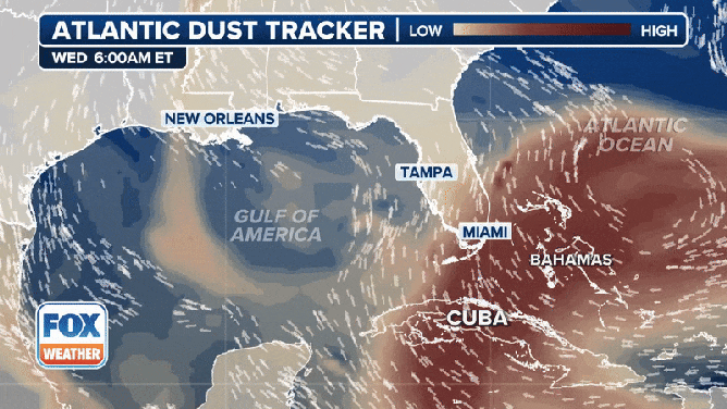
A look at the Atlantic dust tracker through Saturday, June 7, 2025.
(FOX Weather)
Watch: Florida bear takes a dip in the ocean, naps in beachfront condo
Sharks aren’t the only thing beachgoers need to be on the lookout for in Florida this summer. A black bear was spotted taking a dip in the Gulf waters off Naples.
A mother and son saw the unexpected creature emerging from the sea last Friday. Video taken by Kylie Nelson shows the bear swimming up to the beach and then taking a stroll.
“Mom, run!” Nelson’s son said as the bear approached the shoreline.
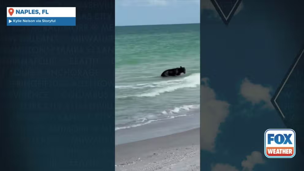
A Florida black bear cooled off in the water off Naples, Florida on May 30 to the amusement of beachgoers.
Before you go
Here are a few more stories you might find interesting.
Need more weather? Check your local forecast plus 3D radar in the FOX Weather app. You can also watch FOX Weather wherever you go using the FOX Weather app, at foxweather.com/live or on your favorite streaming service.
It’s easy to share your weather photos and videos with us. Email them to weather@fox.com or add the hashtag #FOXWeather to your post on your favorite social media platform.
Source link
editor's pick
latest video
Sports News To You
Subscribe to receive daily sports scores, hot takes, and breaking news!