Significant severe weather threat targets central Plains to mid-Mississippi Valley

A potentially volatile setup is shaping up across the Plains and mid-Mississippi Valley on Monday with severe thunderstorms expected across a broad region from Kansas and Oklahoma to parts of Missouri and Arkansas.
OKLAHOMA CITY, Okla. – After several days of potent and deadly storm activity, the central U.S. will remain under a heightened risk of severe weather on Monday.
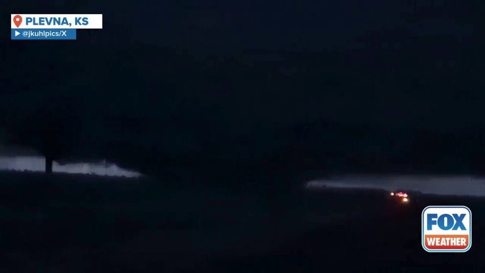
A video shared from Plevna, Kansas, shows a massive wedge tornado being illuminated by flashes of lightning as it spins across the landscape on Monday, May 19.
The FOX Forecast Center warns that a wide region from Kansas and Oklahoma extending into parts of Missouri and Arkansas is expected to experience severe thunderstorms. By early afternoon, eastern Kansas, Oklahoma, northern Texas and the Ozarks will be primed for severe storms to develop.
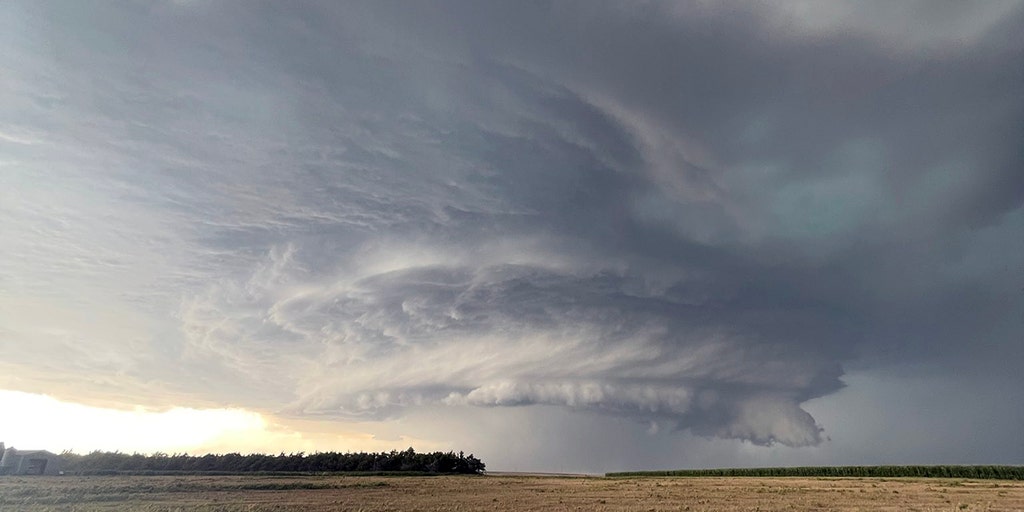
Significant damage was reported in western Kansas early Monday morning after powerful storms produced tornadoes that damaged numerous homes and brought down trees and power lines amid a rare Tornado Emergency.

(FOX Weather)
A concerning Level 4 out of 5 severe weather threat includes major cities like Oklahoma City, Tulsa, Norman and Broken Arrow in Oklahoma, as well as Fort Smith, Arkansas.
“The thunderstorm development that we’re expecting later today could produce some very large tornadoes,” FOX Weather Meteorologist Britta Merwin said.

(FOX Weather)
Some of the tornadoes could be intense (EF-3 or stronger), with very large hail and severe winds. Multiple lines of severe storms will push eastward into Missouri and Arkansas, carrying the threat of damaging winds and embedded tornadoes.
Intense severe storms likely Tuesday from Ohio Valley to Tennessee Valley
Severe thunderstorms will rumble into Tuesday across parts of the Ohio Valley and the mid-Mississippi and Tennessee valleys, with the potential for more damaging winds, large hail and a few tornadoes. Thunderstorms may already be ongoing Tuesday morning, especially across Illinois, Indiana and possibly Kentucky.
“You have to think about these outlooks sometimes as a continuing story,” Merwin said. “What develops later today is going to be dragging into the overnight into tomorrow.”
As temperatures and humidity climb throughout the day on Tuesday, the atmosphere will become unstable. This can set the stage for strong to severe storms in multiple areas.
KENTUCKY TORNADOES: NEARLY 2 DOZEN DEAD AS SEVERE WEATHER OUTBREAK TEARS ACROSS OHIO VALLEY

(FOX Weather)
A Level 3 out of 5 threat for severe storms includes major Tennessee cities like Memphis, Nashville, Clarksville and Murfreesboro, as well as Huntsville, Alabama.
Farther south, ingredients will come together to provide an environment favorable for supercells. Initial supercells will pose a risk of all severe storm threats, including the potential for strong tornadoes. With the atmosphere not being disturbed, an organized line of storms will develop and push eastward by Tuesday evening.
By Wednesday, the cold front will be along the mid-Atlantic and Carolina coastlines. With any daytime heating, there is a chance of severe storms from Virginia to southeastern Georgia, especially in the afternoon, the FOX Forecast Center said.
Source link
editor's pick
latest video
Sports News To You
Subscribe to receive daily sports scores, hot takes, and breaking news!