One week after historic blizzard, another winter storm expected to slam the Midwest and Northeast
Another winter storm is forming, potentially bringing heavy snow and ice to the Midwest and Northeast. Right now, it appears snow is most likely to span from the Mississippi Valley through the Great Lakes, and eventually into the Northeast. But the forecast may change as the week goes on. Stay with FOX Weather for the latest.
Just one week after a historic blizzard pummeled the region, another winter storm is expected to bring significant snow and ice to the Midwest and Northeast.
EVEN MORE ROUNDS OF SNOW THIS WEEK THREATEN NORTHEAST CITIES PUMMELED BY RECORD-BREAKING BLIZZARD
The setup begins Saturday, when a quick shot of cold air settles across the northern third of the country.

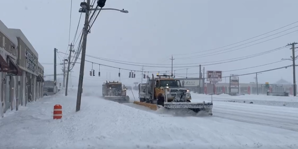
Strong winds and heavy snow pound Somers Point, NJ, amid Feb. 2026 blizzard
(Zach Blum / FOX Weather)
By Sunday, a weak disturbance will emerge from the Rockies, increasing southerly winds a few thousand feet above the surface. Those winds will funnel warmer, moisture-rich air northward, where it will ride up over the cold, dense air already in place.
This will allow for the development of precipitation, which could fall as snow, sleet, freezing rain, or plain rain depending on how deep the cold air is.

Someone marveling at the amount of snow in Brooklyn, NY.
(Jolie / FOX Weather)
According to FOX Forecast Center, forecast models are suggesting that the snow will most likely span from the Mississippi Valley through the Great Lakes and eventually into the Northeast.
It will begin with cities like Chicago, Indianapolis, Cleveland and Pittsburgh getting hit as early as Sunday. The system will push eastward into areas still digging out from the blizzard, including Philadelphia, New York, Providence, RI and Boston.

(FOX Weather)
South of the snow, ice will be a concern. The greatest risk for icing currently appears to be along the I-70 corridor.
The FOX Forecast Center says that the magnitude of the impacts of the storm still remains unclear.
Providence broke its record for all-time biggest snowstorm and snowiest day ever on Monday during Blizzard ’26. Snow totals approached three feet on Monday afternoon.
The amount of energy that ejects out of the Rockies will determine how significant this storm becomes. If more energy transfers from the trough and closed low, there will be a more significant risk for major winter precipitation.
However, if the jet stream dip over the Northeast holds stronger and less Pacific energy and moisture moves eastward, then the storm will be less impactful.
These details will be worked out in the coming days, but for now, the chance of an impactful storm is far from minimal.
Stay with FOX Weather as these systems continue to develop.
Source link
editor's pick
latest video
Sports News To You
Subscribe to receive daily sports scores, hot takes, and breaking news!