Bitter Arctic air invasion to freeze millions of Americans after massive storm
With a monster snowstorm barreling down on the Midwest, FOX Weather Meteorologist Jane Minar is live in Traverse City, Michigan with the latest.
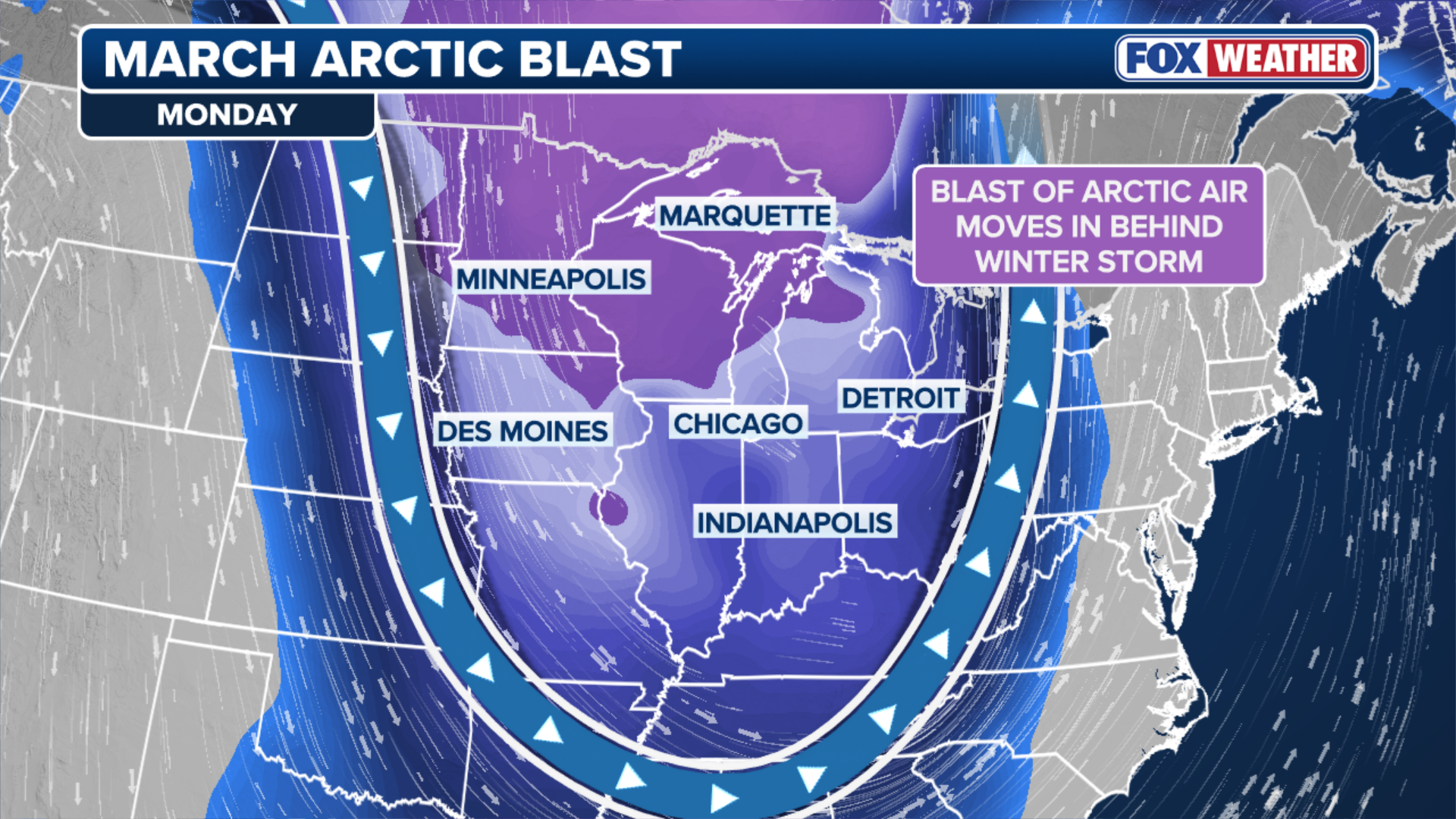
Immediately charging in behind the powerful bomb cyclone blizzard, a bitter blast of Arctic air will plunge much of the East back into a frigid, winter-like feel.
Over 230 million Americans will experience below-average temperatures through Monday and Tuesday.
It comes after a monstrous blizzard bomb cyclone unleashes extreme feet of snow and vicious wind gusts throughout the Midwest and Great Lakes.
The blizzard will drop feet of snow and create long-lasting impacts into the start of this week, halting travel at major Midwest hubs as the storm creates impossible driving conditions.
-

Snow falling in Frederic, Michigan, on Sunday, March 15, 2026.
(Morgan Stahl) -

The northeastern US and Canada are experiencing an Arctic blast that could see some areas record their lowest ever wind chill temperatures.
(ANGELA WEISS/AFP via Getty Images) -

Tree covered in ice at Point Betsie Lighthouse in Lake Michigan on Sunday, March 15, 2026.
(Jane Minar) -

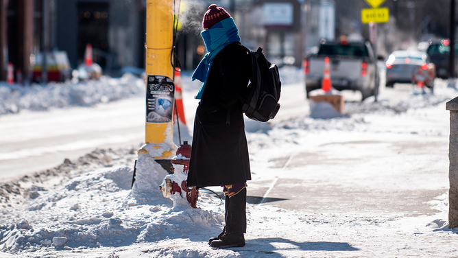
FILE – A man walks through the snow with a scarf over his face in Washington, DC, on January 8, 2014, as dry and unseasonably cold weather hits the area. An Arctic blast sweeping Canada and parts of the United States this week closed schools, grounded jets, killed at least four people, and even shook the ground. AFP PHOTO/JIM WATSON (Photo credit should read JIM WATSON/AFP via Getty Images)
( ) -

Snow falling in Marquette, Michigan, on Sunday, March 15, 2026.
(Robert Ray) -

The breath of commuters is visible as they walk to a subway stop bundled up against the frigid cold on the east side of Manhattan.
(STAN HONDA/AFP) -

Snow falling in Marquette, Michigan, on Sunday, March 15, 2026.
(Robert Ray) -
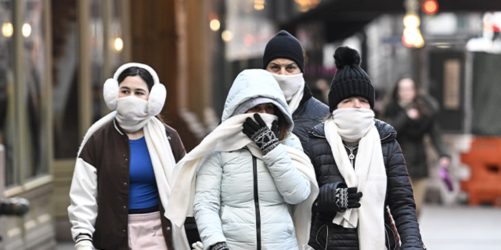
A woman is bundled up as winter weather conditions sweep across the U.S.
(STEPHEN MATUREN/AFP via Getty Images)
Following the powerful storm, any snow that falls will likely remain on the ground for at least several days.
Monday also features a rare Level 4 out of 5 for destructive severe weather and even long-track tornadoes along the East Coast, including the nation’s capital, Washington, DC.

(FOX Weather)
The severe storm threat kicked off in the Heartland Sunday afternoon and will move east over Georgia, the Carolinas, Virginia, up into Pennsylvania and New Jersey, with a high risk for dangerous winds and strong tornadoes.
TORNADO SAFETY: THE SAFEST AREAS TO PROTECT YOURSELF AND WHY TO AVOID OVERPASSES
The below-average temperatures will move in by Tuesday as strong northwesterly flow behind the storm pulls arctic air south and east.
(FOX Weather)
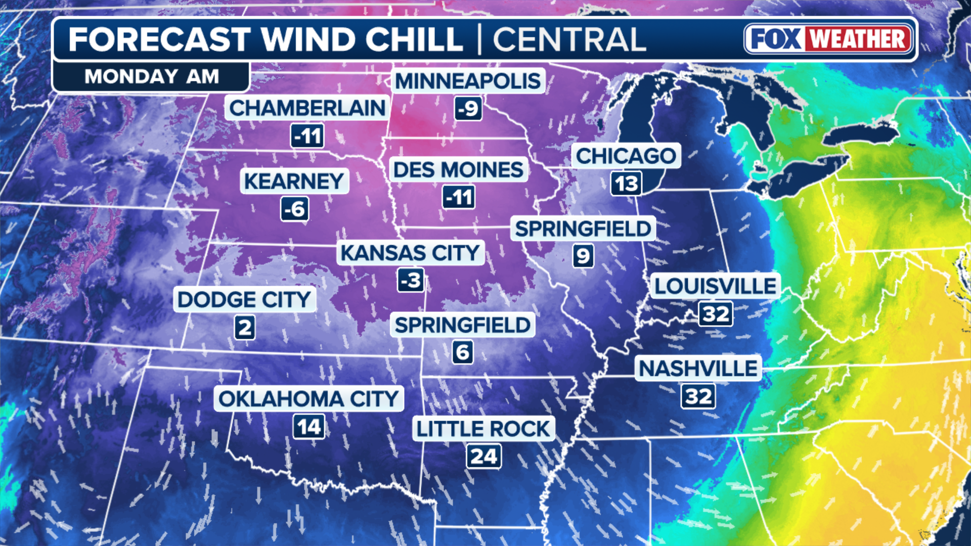
Portions of the Plains and Midwest will start feeling the chill return on Monday, with afternoon highs running 12 to 25 degrees below average. These below-average temps will extend from the Canadian border all the way south to the Texas-Mexico border.
Afternoon highs will peak in the teens and 20s across the Midwest, and in the 40s and 50s across the mid-South.
(FOX Weather)
Overnight into early Tuesday, wind chills will drop into the negative single digits and teens for cities like Minneapolis and Green Bay, and into the teens and 20s for areas like Oklahoma City and Atlanta.
The FOX Forecast Center said over 30 new record lows are possible across the South on Tuesday, with some records being well over 100 years old.
WHAT DOES THE WIND CHILL MEAN?
More than 11 million Americans are under blizzard warnings as snow and freezing rain continue to threaten parts of the Midwest and the Great Lakes. FOX Weather Meteorologist Jane Minar has the latest.
Temperatures will only rebound slightly by Tuesday afternoon, as they’ll remain below average for millions. Highs will once again run nearly 20 to 30 degrees below average for major cities such as St. Louis, Atlanta and Washington, D.C.
Many areas will remain in the mid-30s on Tuesday before temperatures slowly warm closer to average by Wednesday and Thursday.
Further to the north, New York City and Boston will wake up to temperatures in the upper teens and 20s by Wednesday morning.

(FOX Weather)
Lower-range outlooks into late March suggest parts of the Northeast may continue to see below-average temperatures, while much of the West Coast sits under record heat.
Source link
editor's pick
latest video
Sports News To You
Subscribe to receive daily sports scores, hot takes, and breaking news!