Historic nor’easter to slam I-95 corridor, feet of snow, blizzard conditions, and life-threatening travel
Millions along the I-95 corridor are bracing for a historic nor’easter blizzard, bringing feet of snow, dangerous winds and life-threatening travel. States of Emergency have already been issued for New Jersey and New York, as impacts have already begun affecting the sky.
A historic nor’easter blizzard is bearing down on the I-95 corridor and could become one of the most significant snow events in years.
Nearly 7,000 flights have already been canceled through Tuesday as this major winter storm is forecast to unleash heavy snow and widespread blizzard conditions from Delaware to Massachusetts, impacting millions of people.
LIVE UPDATES: NYC, BOSTON, PHILLY BRACE FOR HISTORIC BLIZZARD ‘BOMB,’ 2+ FEET OF SNOW EXPECTED
States of Emergency have been issued for New York and New Jersey and could expand with the strength of the storm.
(FOX Weather)
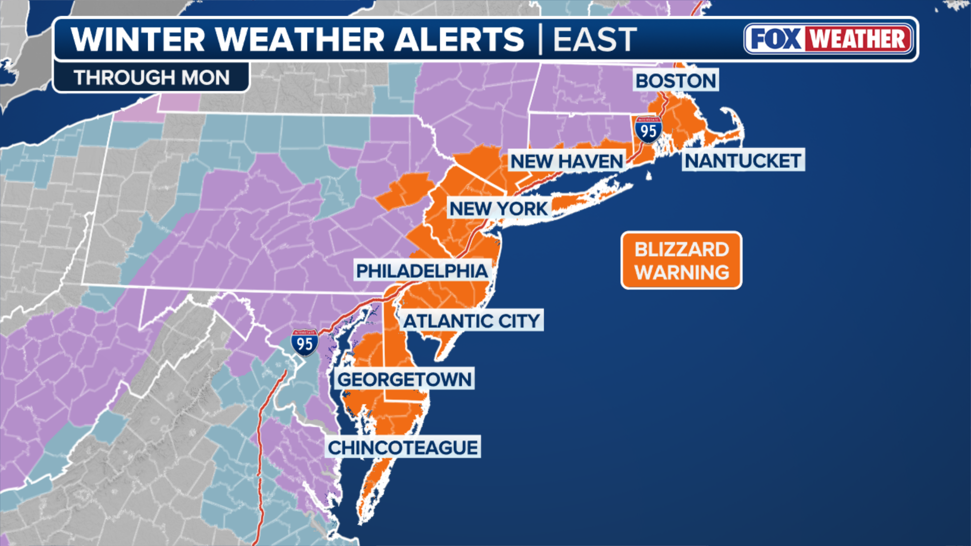
Blizzard Warnings are in effect for 30 million people from Maryland to Massachusetts, including in New York City, New Haven, Connecticut, Providence, Rhode Island and Boston.
According to the FOX Forecast Center, this is the first Blizzard Warning in New York City since March 2017, and since January 2022 for Boston and Providence, highlighting the strength of this storm.
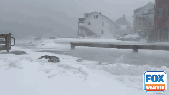
FILE: Blizzard conditions in Gloucester
(FOX Weather)
The Blizzard of 2026 is rapidly intensifying as a low-pressure system moves off the North Carolina coast Sunday. Forecasts show the storm dropping around 40 millibars in just 24 hours — nearly double the threshold for bombogenesis — signaling that explosive strengthening is likely.
This rapidly deepening storm is expected to unleash near-zero visibility across the heavily populated I-95 corridor, posing a serious threat to travel and safety.
(FOX Weather)
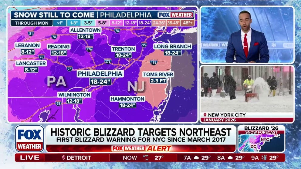
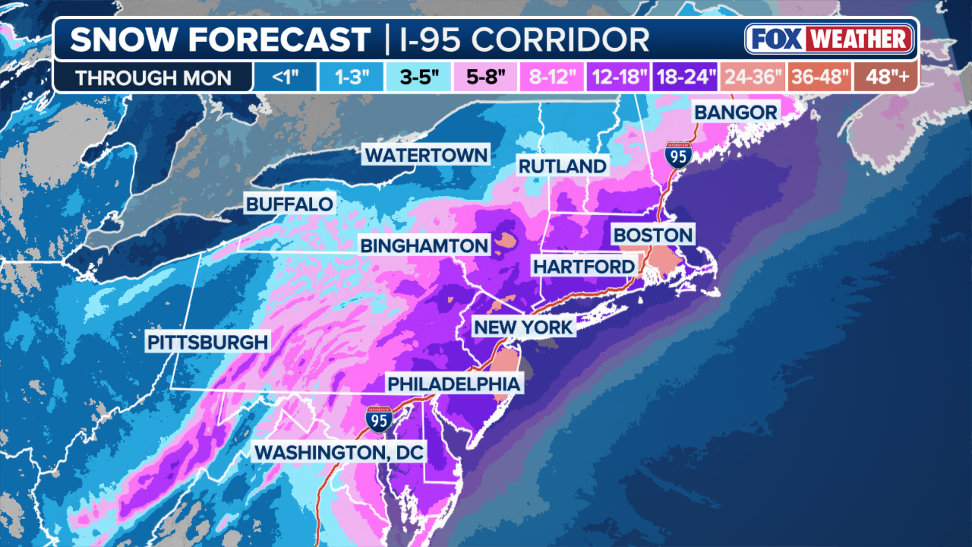
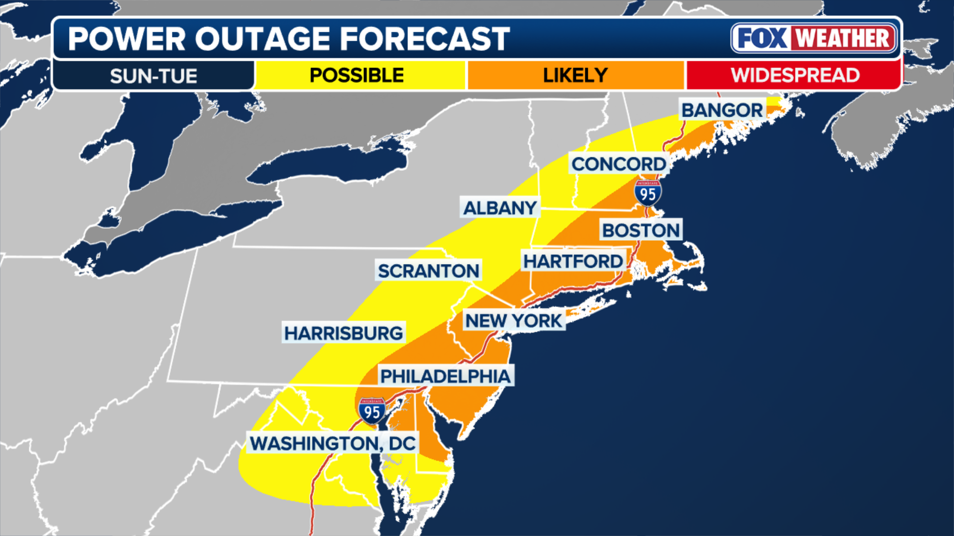
Snowfall totals of 1 to more than 2 feet are expected along much of the corridor, with intense snowfall rates and strong winds likely to create dangerous, potentially life-threatening travel conditions and scattered power outages.
In several major cities, this storm could rank among the top 10 — and possibly even the top five — snowstorms on record.
(FOX Weather)
Coastal flooding is another concern for coastal areas from Delaware to Maine, with Coastal Flood Warnings in effect Sunday night and lasting until Tuesday.
Significant beach erosion is likely with up to 3 feet of coastal flooding possible.
Around mid-morning, the storm will be fully off the coast and will begin the process of bombing out. At this time, those across central Pennsylvania down into northern Virginia, will notice the snow picking up.
New York should be all snow by 1 p.m., Philadelphia by 3p.m. and Washington DC, Baltimore by 5p.m.
As the sun sets, conditions will rapidly go downhill as the storm explosively intensifies off the coast.
-

FILE: Snow covers cars parked on the street in New York City.
(FOX Weather) -

A Boeing 737 American Airlines passenger aircraft is parked at gate on the tarmac of LaGuardia airport in New York on January 25, 2026.
((Photo by CHARLY TRIBALLEAU / AFP via Getty Images)) -

A measuring stick shows 28 inches of snow in Fair Haven, New York on Jan. 2, 2026.
(Brandy Campbell) -
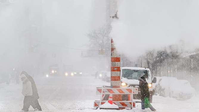
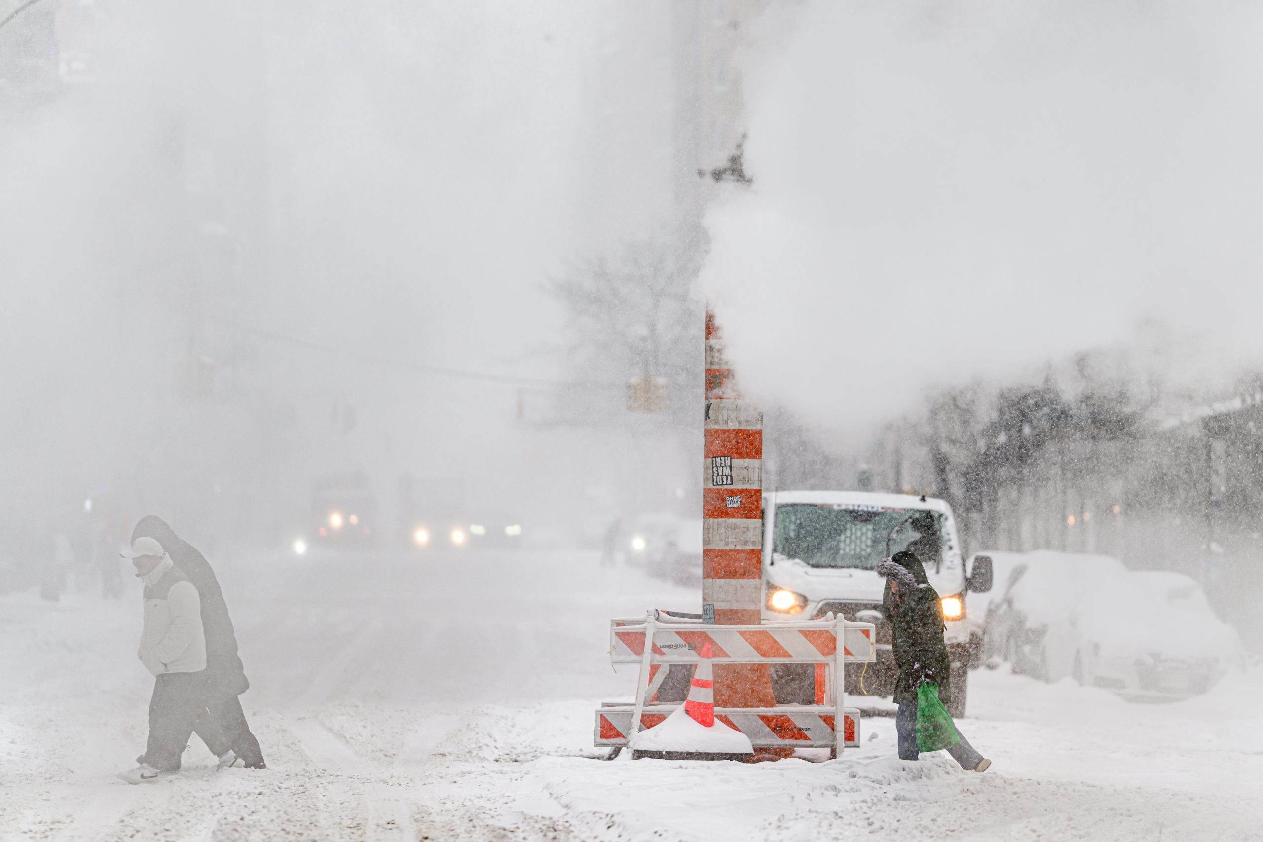
NEW YORK, NEW YORK – JANUARY 25: Pedestrians make their way across the street as a major snow storm sweeps across the eastern United States, delivering an estimated two feet of snow, on January 25, 2026 in New York City.
( Roy Rochlin) -
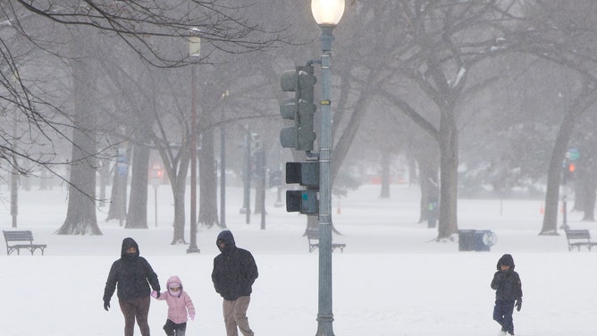
A family walks in the snow near the National Mall in Washington, DC, on January 25, 2026.
(Amid FARAHI ) -
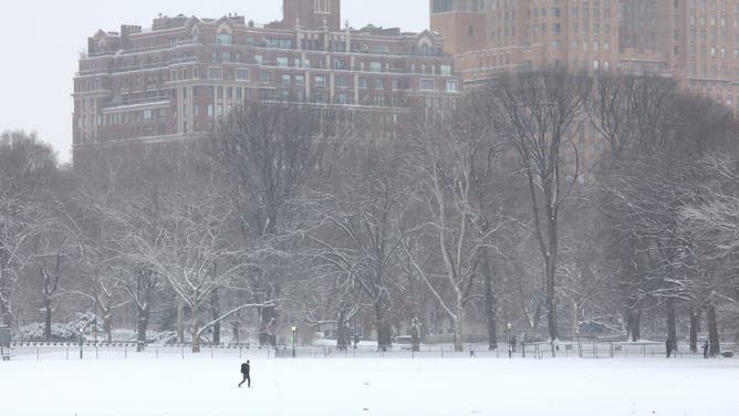
A person walks through a snow-covered Central Park in New York City on December 27, 2025.
(TIMOTHY A. CLARY / AFPv) -
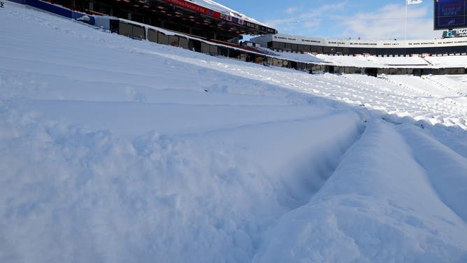
ORCHARD PARK, NEW YORK – JANUARY 15: A general view of snow filling the stands at Highmark Stadium before the game between the Pittsburgh Steelers and the Buffalo Bills on January 15, 2024 in Orchard Park, New York.
(Timothy T Ludwig)
Extremely heavy snow will develop during the overnight hours. Snow rates of 1 inch per hour are expected, with even 2 inches per hour likely as well.
Some spots could even see rates peak at an incredible 3–4 inches per hour.
At this point, travel will be dangerous to near impossible.
(FOX Weather)
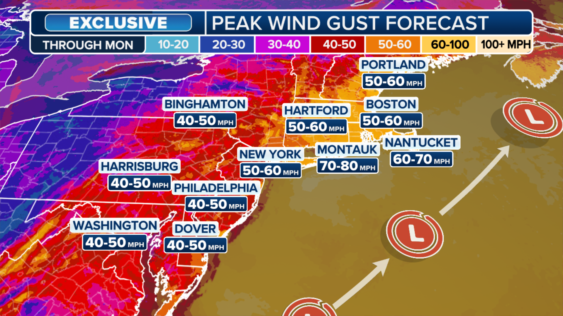
High winds will produce gusts up to 60 mph from the Jersey Shore over toward Long Island overnight, with Philadelphia and New York seeing gusts over 40 mph during this time.
As the sun rises on Monday, the blizzard will be in full force.
Heavy snow will be breaking out across Connecticut, Rhode Island and Massachusetts, accumulating between 1–3 inches each hour.
With winds continuing to strengthen, potentially topping 70 mph on the east end of Long Island and up into southeast New England, power outages, potentially widespread, will be very likely as the wind continues to blow all while heavy snow piles onto the branches of trees.
Snowfall of 1–2 feet is expected from Philadelphia to Boston, with the FOX Forecast Center calling for New Jersey and eastern Massachusetts to likely be the “jackpot” of this major storm.
These areas could see bands of intense snow, and several cities may experience one of their top 10, or even top 5, snowstorms on record.
Stick with FOX Weather for the latest updates as this storm continues to develop.
Source link
editor's pick
latest video
Sports News To You
Subscribe to receive daily sports scores, hot takes, and breaking news!