
Cross-country winter storm threats growing from the West

A potential cross-country storm is expected to move into the Southwest or Southern Plains this weekend, with impacts depending on how the system develops. One scenario favors the South with rain and snow, while another shifts the threat northward, bringing the potential for significant snowfall.
It’s been an active winter across the East, with a steady parade of clippers and coastal storms. Now, a massive cross-country winter storm is building in the West, with the potential to bring rain to the South and significant snow to the northern states.
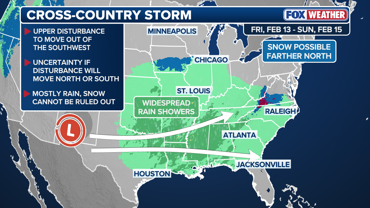
According to the FOX Forecast Center, an upper-level disturbance is forming and is expected to move out of Baja California and into the Southwest or Southern Plains starting on Friday and into the weekend.
HOW HIGH PRESSURE AND LOW PRESSURE DRIVE THE WEATHER
As the system emerges into the Southern U.S., it is likely a low pressure system will develop and will track into the Southeast, causing widespread rain and thunderstorms.

A pedestrian navigates a driving rainfall in Charleston, South Carolina.
(Scott Olson / Getty Images)
As the system spreads, there are two scenarios that may occur.
In the first scenario, the low-pressure system will remain in the South and never venture into the North. The system will eventually move across the Gulf Coast states and then slide offshore near the Southeast coast.
This would keep the system separated from the cold air currently impacting the North. As a result, impacts would be focused farther south, with more rain than snow. In the North, snowfall would be limited or nonexistent.
(FOX Weather)
In the second scenario, the low-pressure system strengthens more aggressively and moves into the Mid-Atlantic and potentially the Northeast. In this case, the system would emerge near the Carolinas and then track northward close to the shoreline. Hence, it could tap into the cold air and produce a significant snowstorm.
As for now, it is uncertain how the system will pan out.
(FOX Weather)
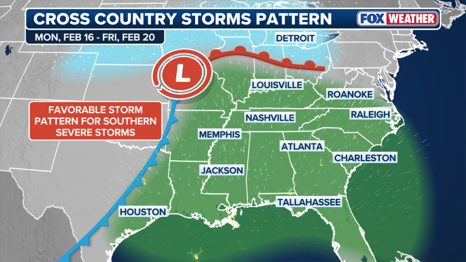
Looking into early next week, a large dip in the jet stream is expected to stall over the West. This will promote an area of high pressure over the east, reversing the weather pattern that has dominated much of the past month.
When this happens, storms will be more likely to form in the West. As they move across the central U.S., they will grow stronger and then push eastward.
But if the area of high pressure becomes too strong, the storms could be pushed towards Canada instead.

People walk on the frozen Frog Pond in the Boston Public Garden during heavy snow on January 25, 2026 in Boston.
(Scott Eisen/ / Getty Images)
On the other hand, if the area of high pressure weakens or moves farther south, it could cause impactful storms to move through the Midwest and into the Northeast.
This not only raises the chances of snow in the North, but can also increase the potential of severe weather in the South.
An area of high pressure in the Southeast will promote warmer air and instability, resulting in stronger thunderstorms.
Source link
editor's pick
latest video
Sports News To You
Subscribe to receive daily sports scores, hot takes, and breaking news!