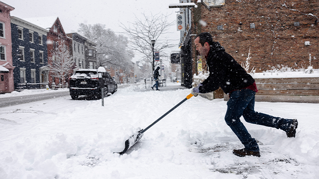
More snow expected for Northeast and Great Lakes ahead of arctic blast

From late Thursday into early Friday, an area of low pressure is expected to move across the northern tier of the U.S. into the Great Lakes before tracking eastward into New England. This system will spread snow across the Great Lakes and into the Northeast, affecting portions of the I-95 corridor.
A fast-moving clipper system is expected to bring additional snow to a region that is already well above its winter average. It comes after a historic winter storm dropped snow accumulations in the double digits for much of the Northeast.
The FOX Forecast Center said an active weather pattern will continue across the eastern U.S. as an area of low pressure is expected to move across the Northern Tier and into the Great Lakes before tracking eastward into New England.

This graphic shows expected conditions across the Northeast on Friday night.
(FOX Weather / FOX Weather)
The Great Lakes and Northeast will see the impacts of a fast-moving clipper system on Friday, with lingering activity expected into Saturday.
Snow will trek out of Canada and spread across the Great Lakes and into the Northeast, with portions of the Interstate 95 corridor likely seeing snow during the season’s coldest arctic blast yet.

This graphic shows forecasted snow totals through Saturday, Feb. 7, 2026.
(FOX Weather / FOX Weather)
New York City could see an additional 1 to 3 inches of snow, while cities like Philadelphia, Pennsylvania, and Albany, New York, will only see up to an inch.
WHAT FACTORS GO INTO A SNOW DAY FOR SCHOOL DISTRICTS?
Higher snow totals are expected in the elevated terrain of West Virginia. Winter Storm Watches have been issued for these mountainous areas, where 5 to 8 inches of snow is possible.

Winter weather alerts are issued in parts of Virginia and Pennsylvania.
(FOX Weather / FOX Weather)
Boston and coastal Massachusetts may see some ocean enhancement, potentially picking up 3 to 5 inches of snow through Saturday afternoon.
MUST-SEE MOMENTS: HISTORIC NOR’EASTER SLAMS CAROLINA COAST AND SHATTERS SNOW RECORDS
This snowfall will impact regions already experiencing a significant winter surplus. Areas downwind of the Great Lakes and much of the Northeast are currently at 110 to 200% of their seasonal average, according to the FOX Forecast Center.

This graphic shows snow totals expected in the Boston metro area this weekend.
(FOX Weather / FOX Weather)
As the system reaches the Atlantic by Sunday, it will briefly strengthen into a more organized coastal system while exiting offshore. Combined with strong high pressure to the west, an increased pressure gradient will generate gusty winds through Saturday.
HOW HIGH PRESSURE AND LOW PRESSURE DRIVE THE WEATHER
This could cause some visibility issues due to blowing snow, with wind gusts of 30 to 40 mph expected across much of the Northeast.

This graphic shows peak wind gusts expected through Saturday.
(FOX Weather / FOX Weather)
WHAT ARE SNOW SQUALLS AND WHY ARE THEY SO DANGEROUS?
There could also be a few snow squalls in Upstate New York, western Pennsylvania and interior New England. In areas prone to snow squalls, visibility can drop rapidly alongside quick accumulations of several inches.
Drivers should be careful on the roads if planning to travel late Friday or early Saturday.
NORTHEAST BRACES FOR DANGEROUS, COLDEST WEEKEND OF THE WINTER AHEAD OF HIGHLY ANTICIPATED WARM UP
Amid a winter of relentless arctic conditions, the most powerful polar punch of the season is expected across the Northeast this weekend, with dangerous wind chills approaching 25 degrees below zero in some places.

Amid a winter of relentless Arctic conditions, the most powerful polar punch of the season is expected this week across the Northeast, with dangerous wind chill temperatures approaching 25 degrees below zero in some places. Powerful winds of the northwest will usher in air associated with the polar vortex. National Weather Service (NWS) offices are keeping a close eye on the weather setup and could issue Extreme Cold Warnings — rarely seen in the Northeast.
Powerful northwest winds will usher in air associated with the polar vortex to the densely populated metro areas of Boston, New York and Philadelphia.
National Weather Service (NWS) offices are keeping a close eye on the weather setup and could issue Extreme Cold Warnings — rarely seen in the Northeast.
Frostbite can set in on open skin within just a few minutes and prolonged exposure to these temperatures could be life-threatening, according to the NWS.
Source link
editor's pick
latest video
Sports News To You
Subscribe to receive daily sports scores, hot takes, and breaking news!