
Impactful snow, rain eyes East Coast as La Niña winter returns

After a brief pause, the La Niña winter weather pattern is back, which will bring the return of cooler across the Northern Tier. The threat of an East Coast storm is growing for late next week that will bring impactful snow and rain to the region.
December featured a classic La Niña winter pattern across the Lower 48, with record warmth along the West Coast and colder air with snow across the northern Plains and Northeast. However, since the start of the New Year, the once-dominating winter weather pattern has been put on pause, making way for a classic January thaw.
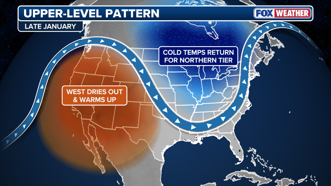
According to the FOX Forecast Center, long-range guidance indicates a return of these conditions, which would bring warmer temperatures back to the West and periodic windows of cooler air and potential snow across the Northern Tier.
(FOX Weather)
Over the next one to two weeks, there is expected to be a notable shift in the weather pattern, as a strong ridge of high pressure over the eastern Pacific moves into the western United States. The shift will bring an end to the widespread rain and snow along much of the West Coast through next week and possibly beyond.
Forecasts suggest the ridge will remain in place and keep the jet stream well north and result in below-average precipitation and a return to warmer-than-average temperatures.
-

People walk in the snow in Central Park in New York City on December 27, 2025. New York City receieved around 4 inches (10 centimeters) of snow overnight. Airlines canceled 1,500 US flights during the peak holiday travel period Friday, with severe winter storm warnings and heavy snow forecast across parts of the Midwest and northeast. (Photo by TIMOTHY A. CLARY / AFP via Getty Images)
(Photo by TIMOTHY A. CLARY / AFP via Getty Images) -
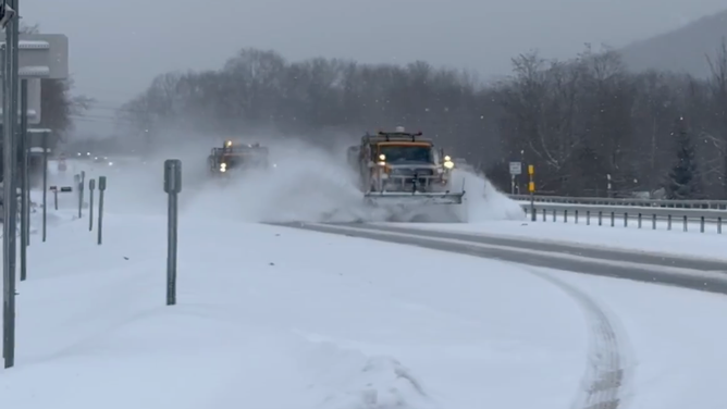
Plows hard at work in Cattaraugus County, New York, clearing snow from roads on Dec. 30, 2025.
(@NYSDOTBuffalo/X) -

A pedestrians pulls a roller bag through the snow during a snowstorm in Chicago, Illinois, US, on Saturday, Nov. 29, 2025. Hundreds of flights have been canceled in and around Chicago and roads are becoming treacherous as one of the busiest travel weekends of the year collides with a major storm bringing wintery conditions throughout the US Midwest Saturday.
(Photographer: Jim Vondruska/Bloomberg via Getty Images) -

Snow across Jim Thorpe, Pennsylvania on Tuesday, Dec. 2, 2025.
(Britta Merwin/FOX Weather)
While the ridge strengthens in the West, the jet stream is expected to extend from southern Canada into the Southeast, similar to the December pattern. This increases the likelihood of colder air pushing into the Upper Midwest and Northeast, where below-average temperatures are expected in mid to late January.
Any storm systems that track along the jet stream could also bring additional chances for snow to the East as a more active weather pattern looks likely.
Longer range forecast models are also showing the possibility for a system to develop along the East Coast as the La Niña pattern begins to take shape late next week.
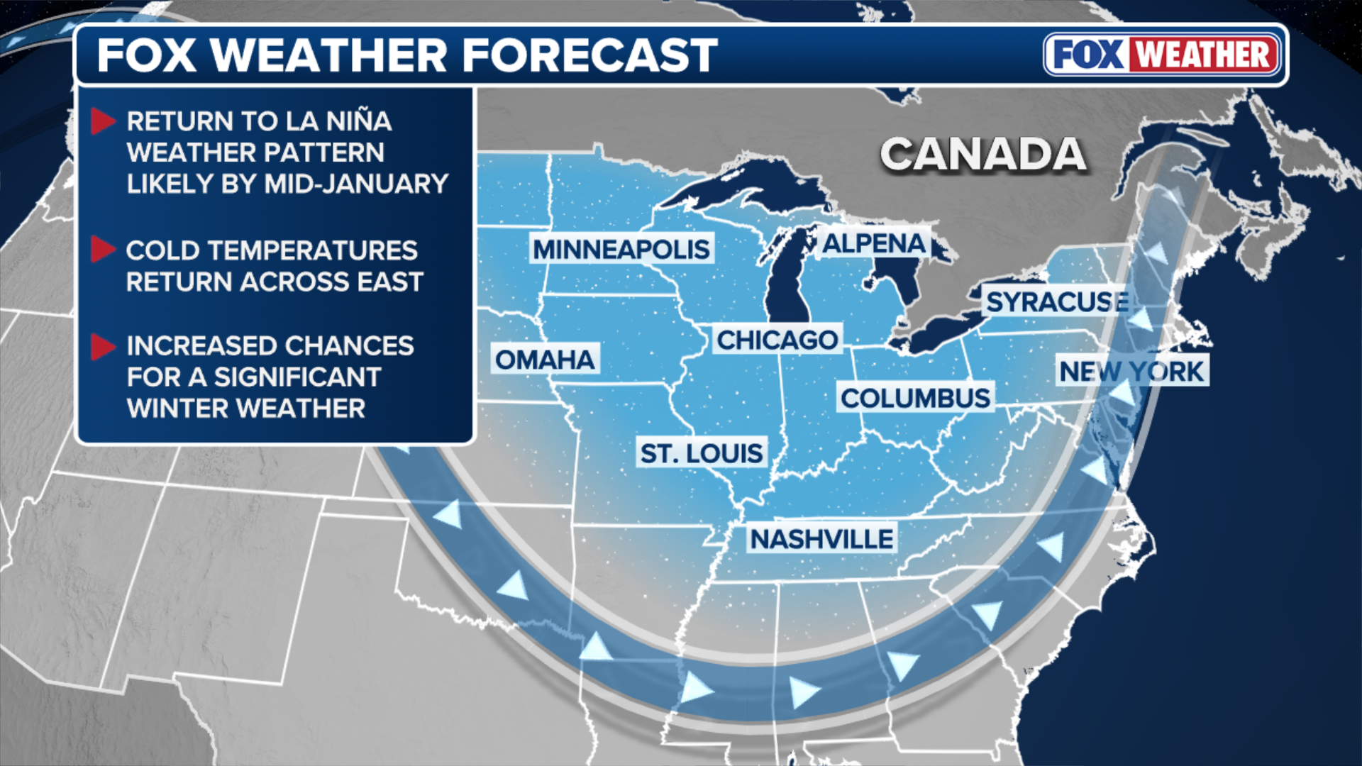
(FOX Weather)
“Right now it looks like numerous pieces of energy will phase, as a dip in the jet stream pushes east. This will increase the potential for a surface low to develop across the Southeast,” according to the FOX Forecast Center.
The system could either move out into the Atlantic or along the Eastern Seaboard.
Behind this system, another could form, which may have a better chance at bringing impactful snow and rain across the East as a blocking high slows things down.
With any longer range outlooks, changes in the forecast may occur since the projected timeframe is over a week out. The FOX Forecast Center will continue to monitor the latest changes in guidance in the coming days.
Source link
editor's pick
latest video
Sports News To You
Subscribe to receive daily sports scores, hot takes, and breaking news!