
Tornado rips through Purcell, Oklahoma. More severe weather forecast for Plains, South and Midwest
A radar-confirmed tornado ripped across Interstate 35 and part of Purcell, Oklahoma Thursday morning, knocking down power lines as a powerful line of thunderstorms barreled their way across the Southern Plains. No one was injured, but western parts of the city were damaged, Purcell Police told FOX Weather.
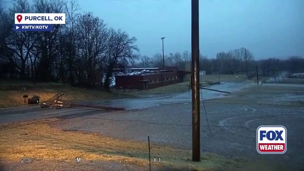
PURCELL, Okla. – A radar-confirmed tornado ripped across Interstate 35 and part of Purcell, Oklahoma on Thursday morning, knocking down power lines as a powerful line of thunderstorms barreled their way across the Southern Plains.
No one was injured, but western parts of the city were damaged, Purcell Police told FOX Weather.

A radar-confirmed tornado ripped across Interstate 35 and part of Purcell, Oklahoma Thursday morning, knocking down power lines as a powerful line of thunderstorms barreled their way across the Southern Plains.
(KWTV/KOTV / FOX Weather)
Storms are ongoing across parts of the Southern Plains and NOAA’s Weather Prediction Center has issued a Level 2 out of 5 risk of severe thunderstorms from Oklahoma City to Tulsa, including the potential for more tornadoes.
Purcell Police Chief Bobby Elmore said the storm moved northeast across the city, knocking down light and power poles around 7:30 a.m. local time. Power outages and gas leaks were confirmed.
THIS IS WHAT YOU SHOULD DO IF YOU ARE DRIVING AND THERE IS A TORNADO ON THE GROUND
A semi-trick was flipped on I-35.
The City of Stillwater sent mutual aid to Purcell, Elmore said.

Warning boxes are color coded as: Severe Thunderstorm Warnings in yellow, Tornado Warnings in red, Tornado Warnings with confirmed tornado in purple, Flash Flood Warnings in green, and Flash Flood Emergencies in pink.
(FOX Weather)
Video from storm trackers showed tree limbs strewn across houses.
A Tornado Watch is in effect for parts of Oklahoma, Arkansas and Missouri through 12 p.m. CT.
FIRST OF TWO POWERFUL CROSS-COUNTRY STORMS UNDERWAY, MILLIONS UNDER SEVERE WEATHER AND FLOOD THREAT
More severe storms will be possible Thursday across the Mississippi River Valley from St. Louis to Oklahoma City and as far south as Monroe, Louisiana. These storms are being driven by a cold front moving ahead of a powerful cross-country system that is set to bring rain to millions across the Plains, Mississippi Valley, and Midwest.
Source link
editor's pick
latest video
Sports News To You
Subscribe to receive daily sports scores, hot takes, and breaking news!