Dangerous lake-effect snowstorm brings winter preview, whiteout travel conditions across Great Lakes

FOX Weather Correspondent Brandy Campbell recorded a powerful band of lake-effect snow over downtown Chicago just after 9:00 a.m. local time, after a lull in the early morning hours. Multiple crashes were reported across Chicagoland with periods of whiteout conditions. Many schools were closed, operating with delays or were shifted online.
CHICAGO – La Niña winter has arrived ahead of schedule as a dangerous lake-effect snowstorm moved through the eastern Great Lakes, creating brief periods of whiteout travel conditions, as Chicago and other parts of the Midwest and Northeast saw their first snow of the season.
The National Weather Service has warned of “dangerous to impossible travel conditions due to intense lake-effect snow” that will cripple travel due to greatly reduced visibility.
Winds could gust up to 30 mph with these heavy lake-effect snow conditions, especially near the Lake Michigan shoreline.
HOW LA NIÑA, POLAR VORTEX WINDS COULD FUEL A FAST-START TO BRUTAL WINTER FOR PARTS OF THE US
(FOX Weather)
The National Weather Service team in Chicago also warned that this lake-effect snowstorm could become “a very dangerous and life-threatening situation beneath the most intense and stationary lake-effect snow bands.”
Those snow bands brought traffic across parts of Interstate 57 south of Chicago to a halt early Monday morning. Commuter Grace Butler told FOX Weather that her car was in standstill traffic for more than an hour, amid near-zero visibility and several crashes.
WHAT IS THE WINTER STORM WARNING CRITERIA?

Powerful bands of lake-effect snow brought traffic across parts of I-57 south of Chicago to a standstill amid whiteout conditions Monday morning. The National Weather Service is warning drivers to use extreme caution. Commuter Grace Butler joined FOX Weather to share her experience.
Indiana’s Department of Transportation reported stalled vehicles and multiple crashes near Chicago, in addition to a jackknifed semi-truck on Interstate 94 north of Waterford.
Many Chicagoland schools were closed, operating with delays or were shifted online Monday morning.
Both FOX Weather Correspondent Brandy Campbell and FOX Weather Exclusive Storm Tracker Brandon Copic recorded a powerful band of lake-effect snow over downtown Chicago just after 9:00 a.m. local time, after a lull in the early morning hours.
HOW MUCH WILL IT SNOW ACROSS AMERICA? EARLY FLAKE OUTLOOK FOR BREWING LA NIÑA WINTER
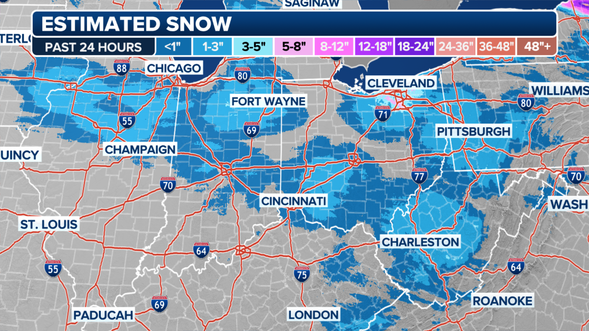
This system packed quite a punch for the first measurable snowfall of the season for communities across the eastern Great Lakes in the Midwest and Northeast.
Valparaiso, Indiana tallied 9.5 inches of snow in a 24-hour period as a heavy band of lake-effect snow covered northeastern Indiana.
Northwest Indiana could see up to two feet of snow, while parts of Michigan and upstate New York are likely to see 8–12 inches with locally higher amounts possible, all told.
LIVE STORM TRACKER FOR LAKE-EFFECT SNOW OUTBREAK

(FOX Weather)
The area of low pressure will move into the Northeast Monday into Tuesday, bringing snow downwind of lakes Erie and Ontario.
Areas just inland of the Great Lakes in upstate New York, Pennsylvania and Ohio are also likely to see 8-12 inches of snow.
WHAT YOU SHOULD KNOW ABOUT BLOWING, DRIFTING SNOW

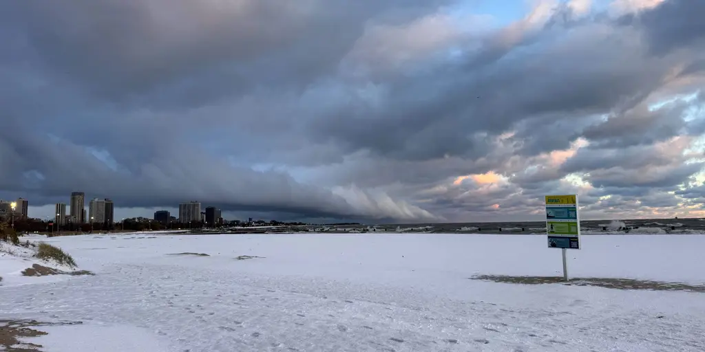
Another band of lake-effect snow looms in the distance over Lake Michigan in Chicago, after heavy bands of snow Sunday night.
(Brandy Campbell/FOX Weather / FOX Weather)
Source link
editor's pick
latest video
Sports News To You
Subscribe to receive daily sports scores, hot takes, and breaking news!