Waves batter Michigan lighthouse as powerful cold front sweeps through
Waves of between 10-15 feet were expected along Lake Michigan as a significant frontal boundary moved through during the end of the week. Video out of Grand Haven, Michigan shows the coastal impacts.
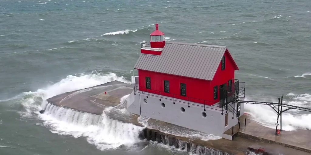
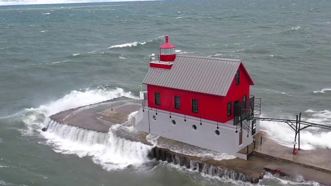
GRAND HAVEN, Mich. – Powerful waves slammed into one of western Michigan‘s most recognizable lighthouses Friday as a significant cold front swept across the Great Lakes, bringing dangerous conditions to coastal areas.
National Weather Service offices across the state issued marine warnings and beach hazard statements, urging swimmers, boaters and pier-goers to stay away from the water.
“Remain out of the water to avoid hazardous swimming conditions and do not venture out on piers,” the NWS warned in a statement.
Forecasters were expecting winds of between 40 to 50 mph and waves of 10 to 15 feet along the Lake Michigan shoreline, while precipitation values were limited to about a quarter of an inch or less.
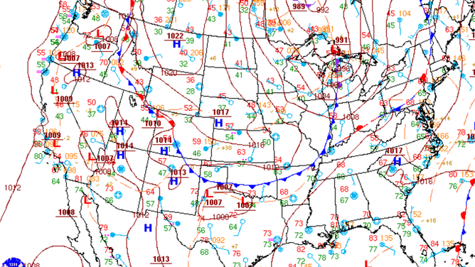
Cold front pushing through the Midwest on Sept. 5, 2025.
(NOAA)
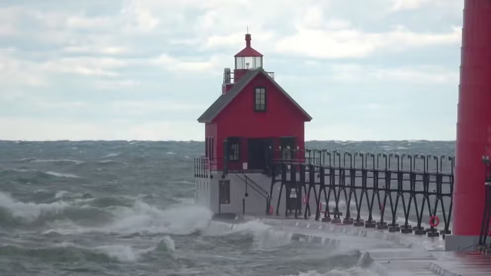
Drone video captured the moments swells hammered the pier and temporarily swallowed the Grand Haven South Pierhead Outer Lighthouse.
“Almost lost the drone. It got soaked,” said Nathan Voytovick, operator of Nate’s Dronography, who estimated that waves climbed as high as 14 feet.
Thermometers across Michigan registered temperatures in the 30s, 40s and 50s, causing the precipitation that fell to feal like a chilly rain.
Drone video by Nathan Voytovick of Nate’s Dronography in western Michigan.
(Nathan Voytovick via Storyful / FOX Weather)
In the far northern Upper Peninsula, witnesses suggested a brief mix of rain and snow occurred in Eagle Harbor, but it did not lead to any ground accumulation.
According to the NWS office in Marquette, the first trace of snow in the Upper Peninsula typically does not occur until late September or early October during colder years and can be as late as November or December.
For much of the Wolverine State, lows are typically in the 50s and highs reach the 70s in early September, so the air is on the order of 5-15 degrees below typical values, making it certainly feal like fall.
WATERSPOUT OUTBREAK OVER GREAT LAKES TRIGGERS NEARLY 100 TWISTERS IN 5 DAYS
During previous cold frontal passages, significant amounts of waterspouts have been reported, as the cooler air creates a stark contrast to the warm surface temperatures of the Great Lakes.
Air temperatures are expected to remain either at or below typical values for the foreseeable future as significant troughiness remains in place across the eastern U.S.

A fall-like air mass swept over the Great Lakes over the past several days, triggering several sightings of waterspouts.
Source link
editor's pick
latest video
Sports News To You
Subscribe to receive daily sports scores, hot takes, and breaking news!