Atlantic tropics may welcome Fernand soon as 90L on brink of development

Invest 90L now has a “near 100% certainty” of becoming a tropical cyclone — perhaps Tropical Storm Fernand — as soon as Saturday or Sunday, the NHC said.
MIAMI – The Atlantic hurricane season is on the cusp of welcoming its sixth named storm to the record books, giving Bermuda yet another storm to sweat the track, but letting the U.S. off the hook.
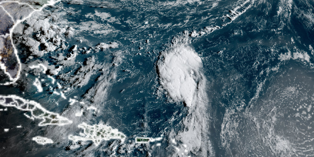
The cluster of showers and thunderstorms, currently designated as Invest 90L, has now developed into a low pressure center about 500 miles south-southeast of Bermuda, according to the National Hurricane Center, and is showing continued signs of organization.

(FOX Weather)
The agency now gives “near 100%” certainty the storm will develop into a tropical cyclone.
“A tropical depression is expected to form later today or tonight, with further intensification to a tropical storm likely on Sunday while the low moves northward over the southwestern Atlantic,” the NHC wrote in its mid-Saturday morning tropics update.
Air Force hurricane hunters will fly into the storm on Saturday to get more detailed readings.
Once the storm reaches tropical storm status, it’ll take the name Fernand.
But the same “atmospheric barrier” weather pattern that prevented Hurricane Erin from ever reaching the Atlantic coast shores is still protecting the East Coast this weekend. Thus, future-Fernand is expected to also stay safely offshore — in fact, head even farther east than Erin’s track.
More good news: Most computer forecast guidance is in agreement that the storm will peak at only tropical storm strength.

(FOX Weather)
However, the storm may pass close enough to Bermuda this time for some potential impacts. The NHC is warning that some tropical alerts may be issued for the island later Saturday.
Once past Bermuda, the storm is forecast to continue to churn north in the open waters, eventually fizzling well offshore of the Canadian Maritimes.
Invest 99L struggling to maintain relevancy
Meanwhile, farther south, the tropical wave known as Invest 99L is on its way to becoming more of a tropical footnote.
This cluster of showers and thunderstorms about 1,000 miles east of the Caribbean’s Windward Islands has become even less organized over the past day, according to the NHC, as wind shear takes a toll.

(FOX Weather)
That unfavorable environment will persist throughout 99L’s journey Saturday, leaving its prospects of further development dim.
The NHC is leaving a straggling chance of development on the board just because there are some slightly more favorable conditions for development looming Sunday and Monday as the storm gets closer to the Windward Islands, but this is most likely just going to bring some tropical showers.
By the time the wave gets into the Caribbean next week, it’ll likely be torn apart.
Beyond 90L and 99L, the tropics look to take a break through the rest of August. However, September is the peak of hurricane season and tropical activity should eventually perk back to life.
Source link
editor's pick
latest video
Sports News To You
Subscribe to receive daily sports scores, hot takes, and breaking news!