When to expect worst from Hurricane Erin on East Coast

FOX Weather Meteorologist Britta Merwin reports from the Point Pleasant Boardwalk in New Jersey where beaches are closed ahead of Hurricane Erin. The hurricane is forecast to bring the biggest waves to the Jersey shore beginning Thursday.
Hurricane Erin’s impacts are already underway across the Southeast, where beaches are closed, and coastal dangers are building for the mid-Atlantic and Northeast regions.
Here’s a breakdown of when those on the East Coast, from the Carolinas to Maine, could see coastal conditions deteriorate this week as Hurricane Erin continues northeastward off the U.S. coastline.
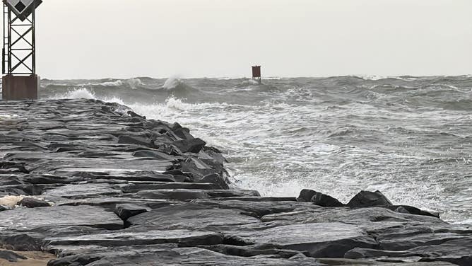
South Carolina: Wednesday-Thursday
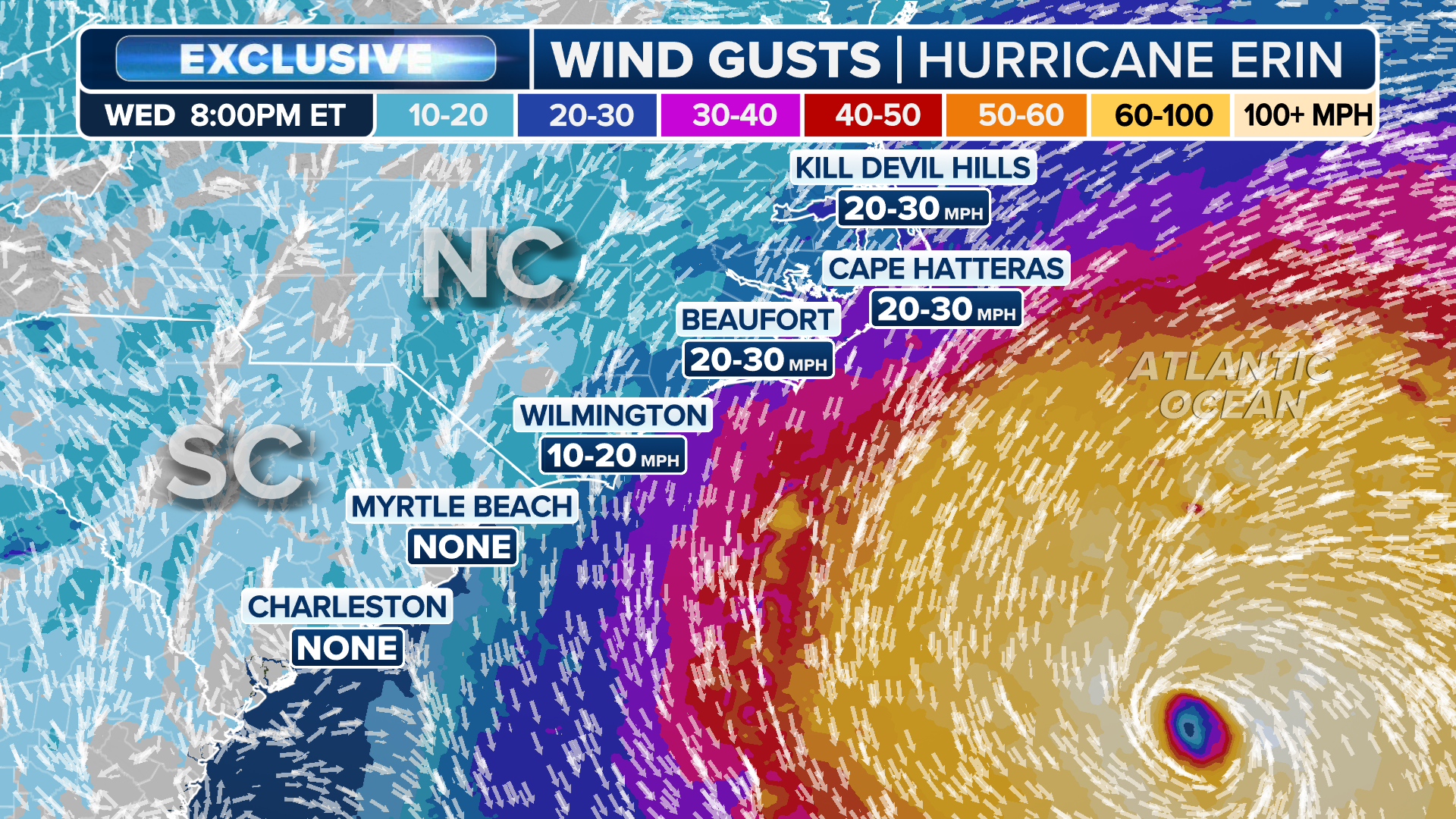
As Erin passes closest to the Carolinas on Wednesday, South Carolina will see its strongest winds along and east of Interstate 95 and along the coast. Gusts of up to 25 mph are possible along the entire Charleston County Coast, according to the National Weather Service in Charleston.
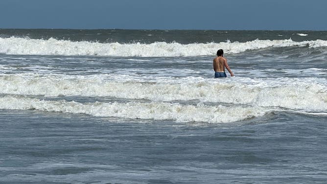
Surf along the beaches near Isle of Palms, South Carolina on Aug. 19, 2025 ahead of Hurricane Erin’s major coastal impacts.
(Robert Ray / FOX Weather)
Large breaking waves and dangerous rip currents will continue through Friday in South Carolina.
(FOX Weather)
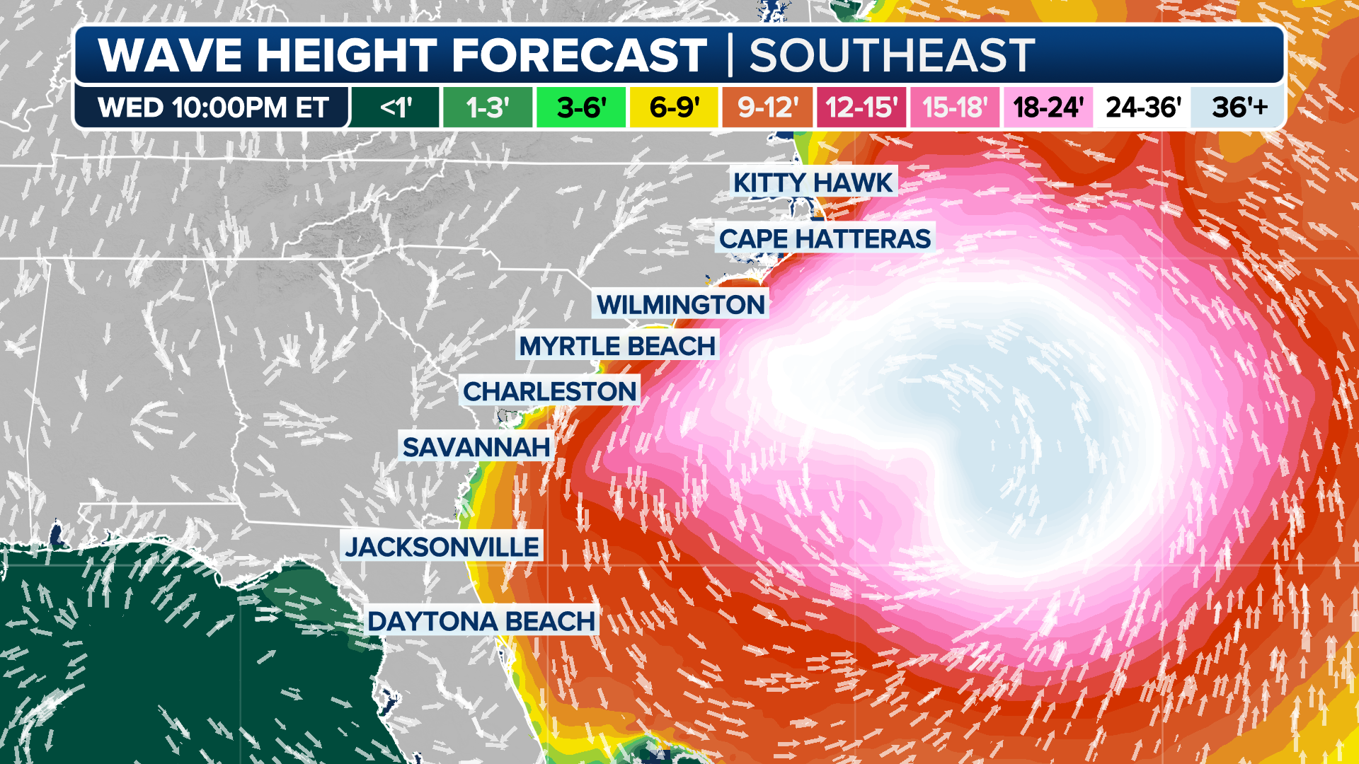
North Carolina: Wednesday night-Thursday morning
Erin will pass offshore of North Carolina on Wednesday night and into Thursday morning, bringing the biggest impacts to the Outer Banks. North Carolina Gov. Josh Stein has declared a state of emergency to assist with the response to Hurricane Erin and to mobilize resources.

A drone video from Exclusive FOX Weather Storm Tracker Mark Sudduth shows monster waves pounding the beach in Rodanthe, North Carolina, as Hurricane Erin churns offshore on Aug. 20, 2025.
Tropical-storm-force winds are possible along the Outer Banks beginning Wednesday night. Gusty winds between 25 and 50 mph are possible in the Outer Banks.
Coastal flood alerts are in place for much of the Southeast, including a warning for the Outer Banks.
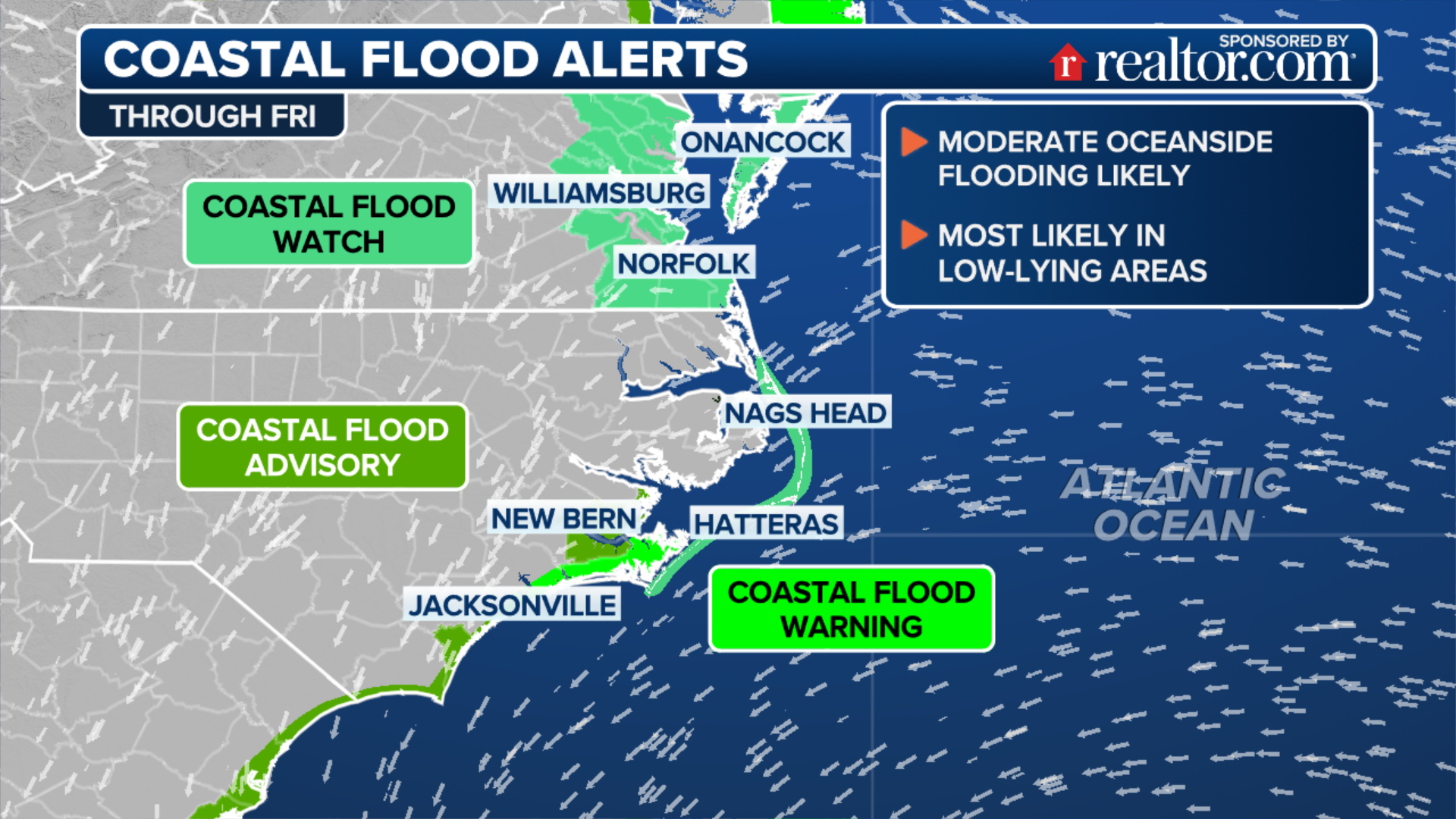
(FOX Weather)
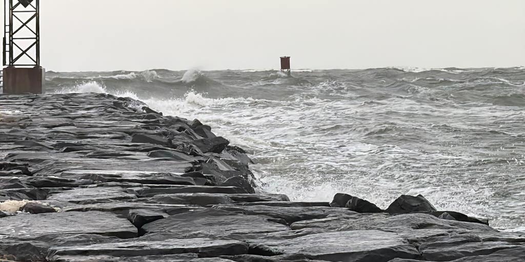
Large waves are beginning to build, and beaches across the coast are closed. Waves are forecast to reach up to 20 feet, with the swell lasting into Friday with 10-foot waves and dangerous rip currents.
(FOX Weather)
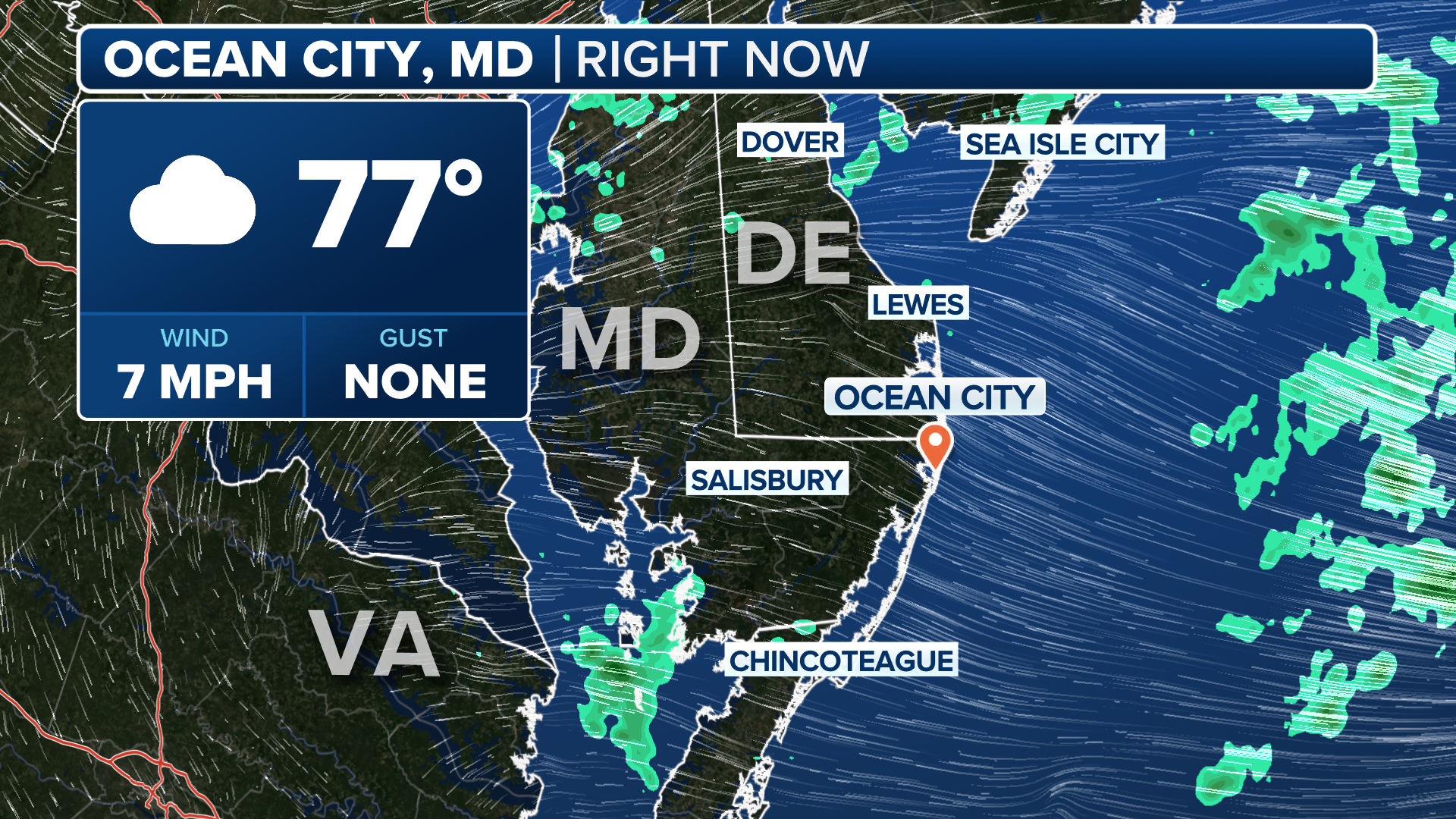
Virginia and Maryland: Wednesday night-Thursday
Peak impacts from Erin will happen late Wednesday and into Thursday for coastal Virginia, where a Tropical Storm Warning is in effect.
Heavy surf pounds the shores of Ocean City, Maryland ahead of Hurricane Erin’s passby later this week.
(Brandy Campbell / FOX Weather)
Large waves, strong rip currents, coastal flooding and strong winds are all possible along the coast. Gusty winds of up to 40 mph are possible on Thursday.
Erin will continue north on Thursday, making its closest approach to the Maryland coast but still remaining well offshore.
(FOX Weather)
New Jersey and Delaware: Thursday-Friday
Throughout Thursday, New Jersey and Delaware beaches will see the most significant coastal hazards with large breaking waves, gusty winds and life-threatening rip currents.
“While the center of the storm will pass about 350-450 miles south and east of our area, it will be rapidly expanding in size with its tropical-storm-force wind field reaching just offshore of our coasts,” the NWS in Mount Holly, New Jersey, said.
(FOX Weather)
A Wind Advisory is in place from Thursday morning through Thursday night from Ocean County southward, where sustained winds of up to 30 mph could last for more than two hours.
On Friday, the weather will clear up, but the dangerous surf and rip currents will remain.
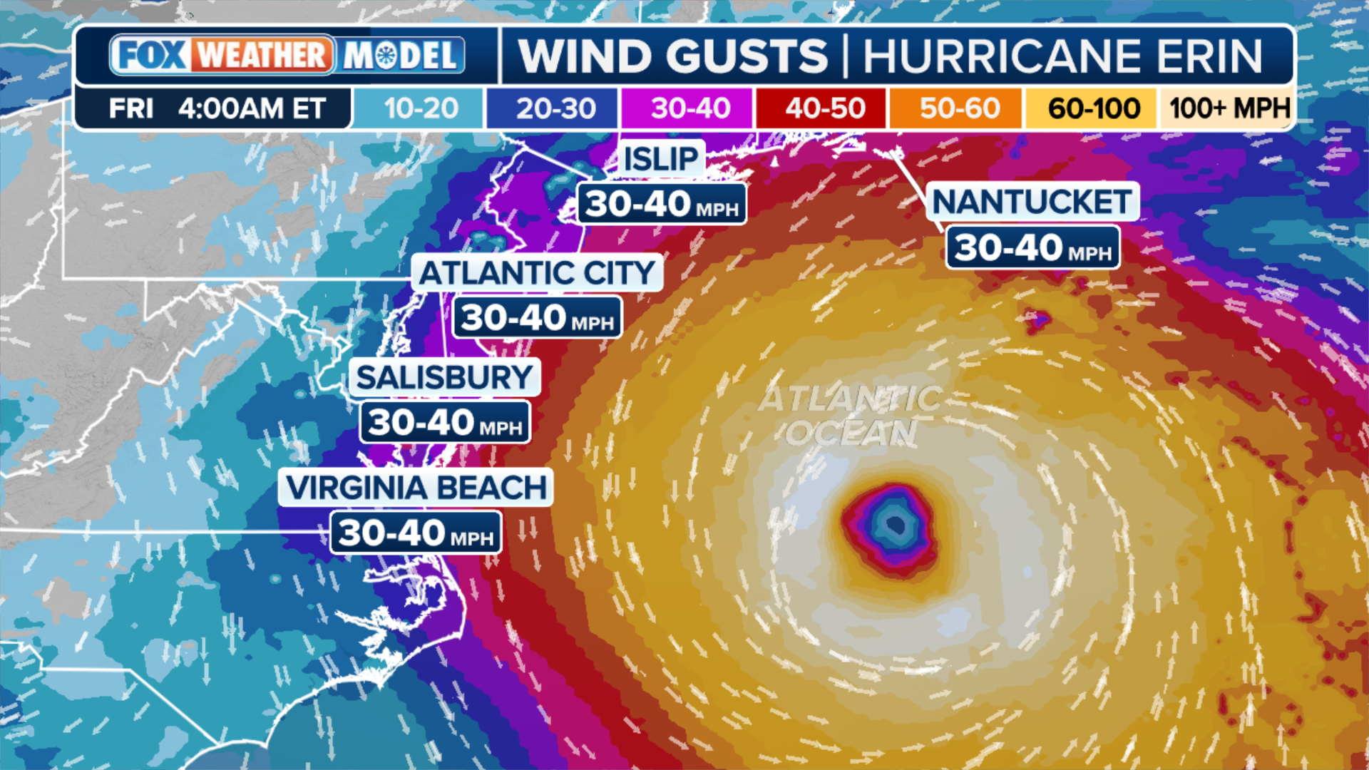
New York: Thursday night-Friday morning
From Thursday through Friday night, Erin will pass southeast of New York.
Winds will peak between late Thursday and early Friday, with localized gusts of up to 40 mph across Long Island and the coast.
Massachusetts and Rhode Island: Friday
Erin will pass well offshore of New England on Friday, where a High Surf Advisory is in place for coastal areas. Large, breaking waves are increasing on Wednesday and will peak on Friday, with waves up to 13 feet in the surf zone.
High surf, dangerous rip currents and gale-force gusts, along with beach erosion, will be the primary threats through Friday.
Maine: Ongoing waves through Friday
The primary threats from Erin in Maine will be offshore with waves up to 9 feet along the coast. Rip currents and coastal erosion are also possible through the weekend.
Source link
editor's pick
latest video
Sports News To You
Subscribe to receive daily sports scores, hot takes, and breaking news!