
Thunderstorms slam I-95 corridor, deadly flooding hits Tennessee

NOAA’s Weather Prediction Center has issued a Level 2 out of 4 flash flood threat is in effect Wednesday for Western North Carolina and eastern Tennessee. That comes after over six inches of rain fell in Chattanooga on Tuesday, the city’s second-wettest day on record. The flooding led to the deaths of three people according to officials.
NEW YORK – Showers and thunderstorms pushed through the Interstate 95 corridor Wednesday, producing heavy rainfall and the threat of flash flooding from the mid-Atlantic to the Northeast.
The storms were associated with a nearly stationary cold front draped across the region, which allowed for an influx of Gulf moisture to stream northward.
Rainfall rates of 1-3 inches per hour were possible in the strongest cells, with daily rainfall totals potentially reaching 4 inches in a few communities.
Areas around higher terrain, including the Poconos, the Catskills and the Appalachian Mountains, were especially vulnerable to flash flooding, as runoff can occur more quickly in steep landscapes.
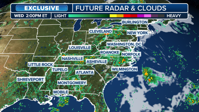
Wednesday wet weather forecast
(FOX Weather)
While the East Coast storms were causing travel headaches, Tennessee was still reeling from deadly flooding that took place on Tuesday evening.
Officials confirmed that flash flooding in southern parts of the state claimed the lives of at least three people, with at least one additional person who was missing.
Weather observation sites around Chattanooga recorded more than a half-foot of rain overnight, which quickly overwhelmed drainage systems and caused some roadways to resemble waterways.
The deluge swamped roads, inundated neighborhoods and forced numerous water rescues, including along Interstate 24, which was shut down for an extended period.
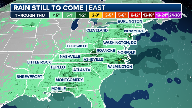
Forecast rainfall map
(FOX Weather)
JELLYFISH SWARM FORCES SHUTDOWN OF FRENCH NUCLEAR POWER PLANT
Much of central and eastern Tennessee was placed under a Flood Watch during the day on Wednesday, due to the risk that additional thunderstorms could train over the same areas.
Forecasters stress that just 6 inches of moving water can knock an adult off their feet, while a foot of floodwater is enough to stall and even sweep away some vehicles.
The combination of the slow-moving frontal system and abundant tropical moisture created an ideal setup for torrential rainfall, a pattern that the FOX Forecast Center expects to linger into at least Thursday.
After the front essentially rains itself out, conditions are expected to turn hotter and drier, with temperatures soaring back into the 90s for much of the Southeast and mid-Atlantic into the weekend.
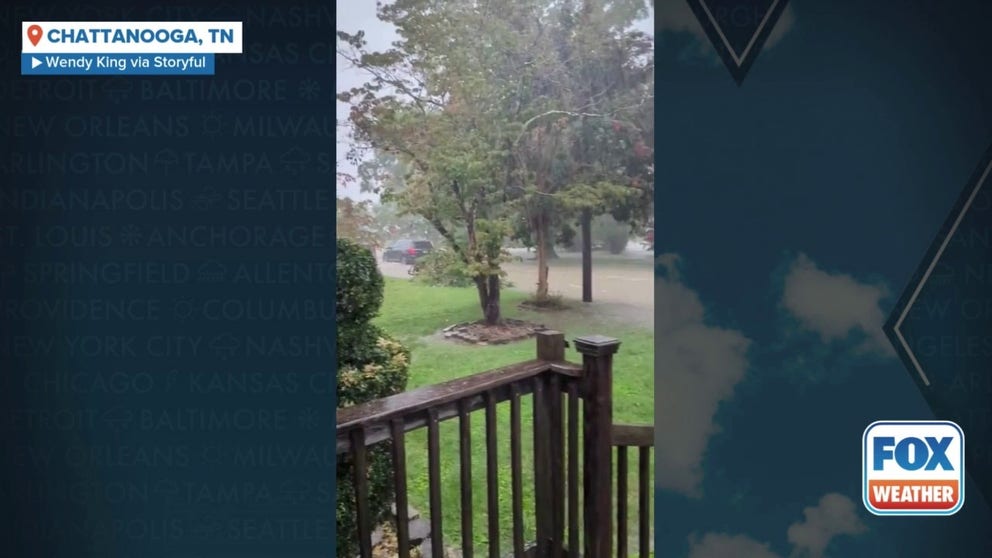
Over 6 inches of rain fell in Chattanooga, Tennessee on Tuesday, the city’s second-wettest day on record after thunderstorms dropped heavy rain ahead of a cold-front that moved through the region.
Source link
editor's pick
latest video
Sports News To You
Subscribe to receive daily sports scores, hot takes, and breaking news!