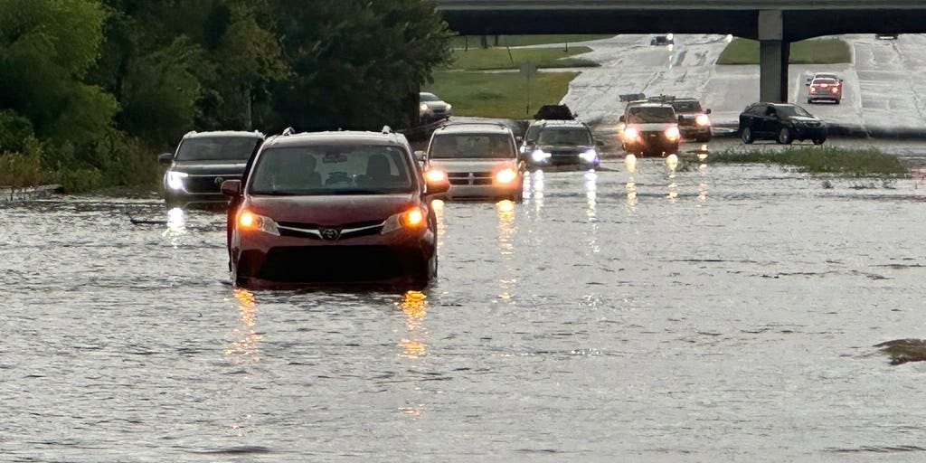
Flooding swamps Interstate 24 in southern Tennessee
Flood alerts? The National Weather Service has been issuing flood alerts for years, here is how do you understand them and what do they mean.
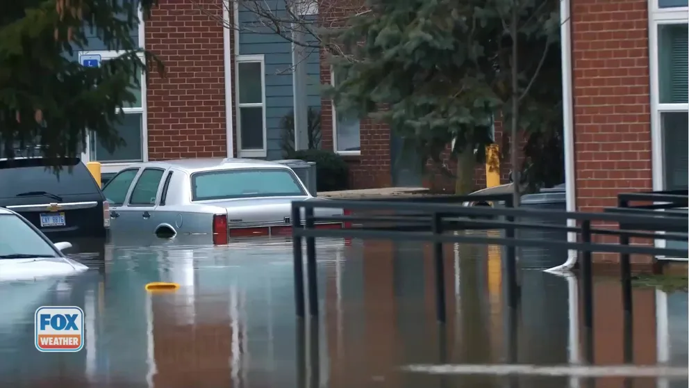
CHATTANOOGA, Tenn. – Torrential rainfall across southern Tennessee forced the closure of a major interstate and prompted dozens of water rescues Tuesday evening as drainage systems were quickly overwhelmed.
The National Weather Service said upwards of half a foot of rain fell around the Chattanooga area, with more possibly on the way.
The Chattanooga Fire Department reported conducting numerous rescues, including pulling stranded drivers from vehicles and assisting residents trapped inside homes as water levels rose rapidly.
Despite the flash flooding, officials said no injuries or missing people had been reported as of Tuesday evening.
One of the hardest-hit areas appeared to be along Interstate 24 southeast of Chattanooga, where floodwaters several feet deep forced crews to close the highway in both directions.
Emergency managers said at least one storm shelter was opened at a local recreation center to assist residents displaced by the flooding.
KNOW YOUR FLOOD TERMINOLOGY: WHAT FLOOD WATCHES, WARNINGS AND EMERGENCIES REALLY MEAN
“Turn around, don’t drown when encountering flooded roads. Most flood deaths occur in vehicles. Move to higher ground now. Act quickly to protect your life,” the NWS said in its Flash Flood Warning bulletin.
Forecasters attributed the deluge to abundant moisture streaming northward from the Gulf, combined with the hilly terrain of the southern Appalachian region, which can enhance convection.
First responders urged drivers to avoid flooded roadways, especially during nightfall when water depths are harder to gauge.
Just 6 inches of moving water can knock an adult off their feet, while a foot of floodwater can cause most vehicles to stall and even be carried away.
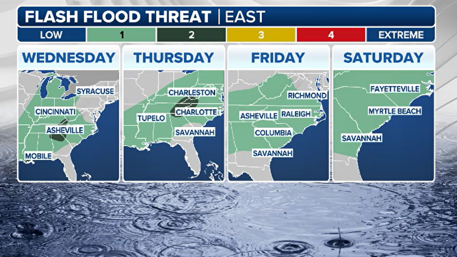
Flash Flood Threat
(FOX Weather)
JELLYFISH SWARM FORCES SHUTDOWN OF FRENCH NUCLEAR POWER PLANT
The storms responsible for Tuesday’s flooding were part of a broader unsettled pattern across the Southeast that is expected to persist for a few more days.
Additional rainfall chances are likely through the middle of the workweek before drier air returns to the Tennessee Valley, the FOX Forecast Center said.
Once the precipitation departs, forecasters expect temperatures to climb, with highs reaching the 90s and heat indexes approaching 100 degrees.
Source link
editor's pick
latest video
Sports News To You
Subscribe to receive daily sports scores, hot takes, and breaking news!