Dangerous heat finally begins to break as scorching July comes to an end
Some cities will see their coolest temperatures of the summer after a brutal heat wave gets knocked down by an incoming cold front. Temperatures will drop first for the Midwest and Northeast but by the weekend relief is coming for the Southeast.
After weeks of scorching the U.S. with dangerously high temperatures, a record-breaking heat dome will finally begin to break down Thursday, ushering in cooler weather and relief for millions.
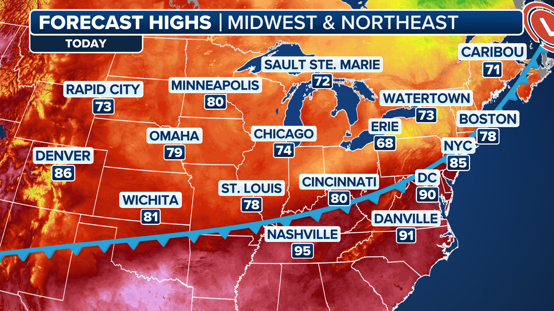
The FOX Forecast Center is tracking a cold front sweeping across the Midwest, plummeting temperatures by 15-20 degrees on Thursday for parts of the Northeast and the central U.S.
This much-needed relief comes after New York City set a record-high temperature at LaGuardia Airport, which registered 99 degrees on Wednesday.
Atlantic City, New Jersey, also recorded a record high of 97 degrees Wednesday.

A teenager drinks water in the heat in a Brooklyn park as the region experiences another heatwave on July 29, 2025 in New York City. Temperatures are expected to reach into the high 90s with a heat index well above 100 degrees.
(Spencer Platt/Getty Images / Getty Images)
Boston flirted with a 100-degree high on Tuesday but by Friday might not hit 70 degrees. Morning temperatures will be crisp, in the 50s and 60s.
Parts of the Upper Midwest and Great Lakes might see morning lows in the upper 40s.
KNOW YOUR HEAT TERMINOLOGY: EXTREME HEAT WARNING, EXTREME HEAT WATCH AND HEAT ADVISORY
The temperature change will be just as dramatic for central parts of the country. By Thursday night, the heat wave will be over for these areas.
Chicago saw triple-digit heat indices on Tuesday, and on Thursday, the Windy City might not reach 80 degrees.
(FOX Weather)
St. Louis is forecast to see a drop into the upper 70s by Thursday, 10 degrees below average for July, according to the FOX Forecast Center.
While this cold front will eventually make its way into the Southeast, the temperature drop won’t be as dramatic.

Extreme heat will remain for another day for parts of the South and Southeast before a cold front will dump heavy rain and cut temperatures at the end of the workweek.
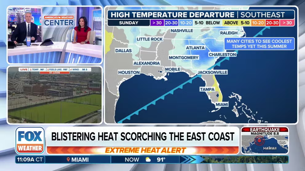
Dangerous heat holds on for another day in the Southeast ahead of heavy tropical rain
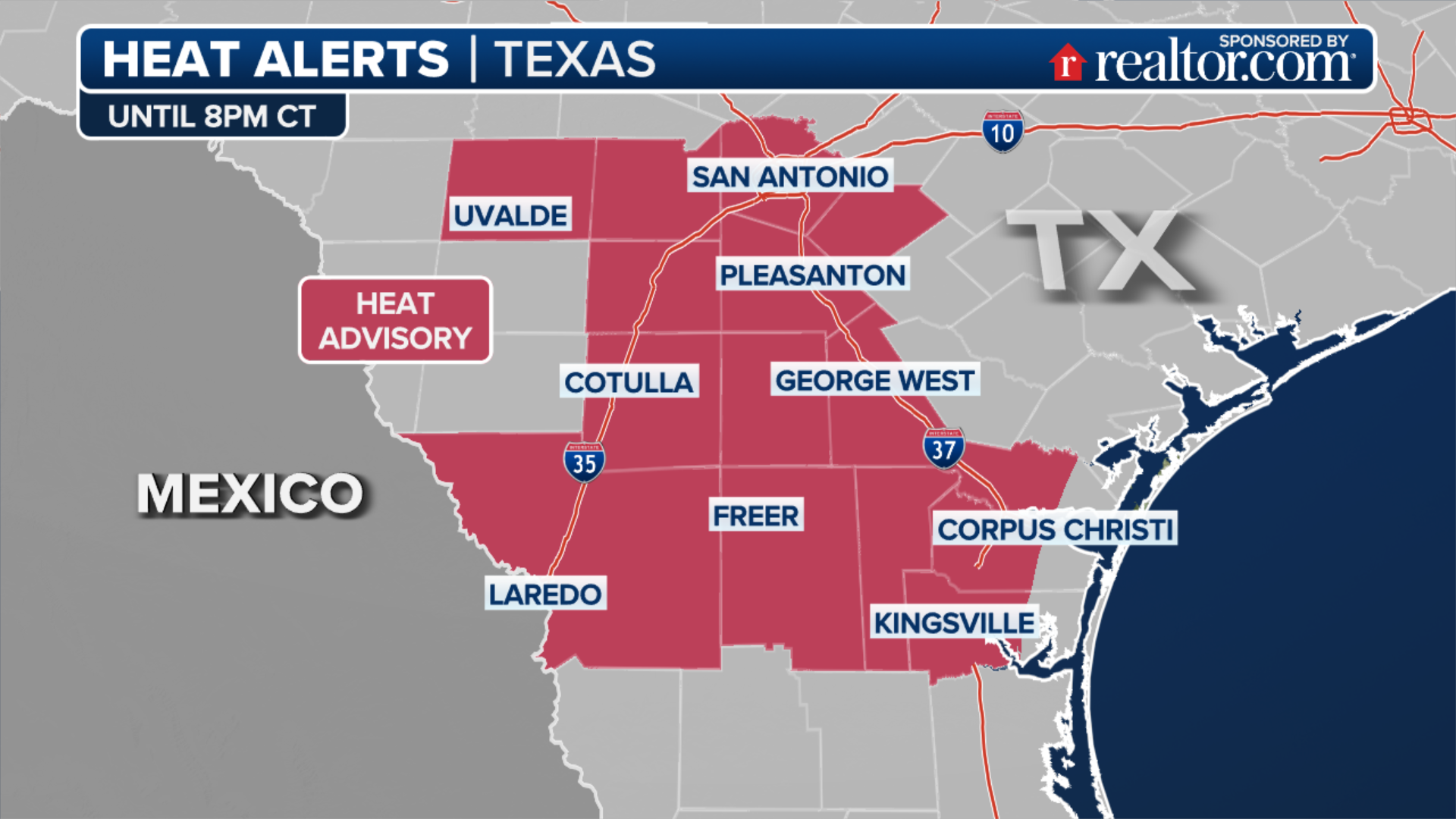
The extreme heat will persist across much of the Southeast Thursday. Extreme Heat Warnings remain in place across much of the lower Mississippi Valley, including Arkansas, northern Louisiana and western Tennessee.
Heat alerts remain across most of the South, as well as most of Florida.
Cities across the Southeast, including Jacksonville, Orlando, Nashville and Atlanta, have been under extreme heat risk for multiple days.
(FOX Weather)
By Saturday, a cold front will finally push into southeastern Georgia, ushering in cooler temperatures in the upper 80s and lower 90s for North and Central Florida by Sunday and Monday.
While 90 degrees isn’t “cool” by any means, the humidity will also be lower, allowing your body to cool more effectively and reducing the overall heat risk.
Temperatures will finally drop into the lower 80s and upper 70s for the Carolinas, Georgia and Alabama by Sunday.
Source link
editor's pick
latest video
Sports News To You
Subscribe to receive daily sports scores, hot takes, and breaking news!