
Bryan Norcross: Atlantic looks to remain quiet for at least the next week, plus a live Q&A this afternoon

Be sure to tune in for a live Q&A with FOX Weather Hurricane Specialist Bryan Norcross at 4 p.m. ET on Thursday, July 31, 2025.
(FOX Weather)
Updated at 9:30 a.m. ET on Thursday, July 31, 2025
We’re going to do a live Q&A this afternoon at 4 p.m. ET. It’s not because anything special is going on, although people still ask great questions. But we want to test our system to stream live to TikTok in addition to Facebook and YouTube. We’ll talk about whatever is on your mind about the tropics and weather in general.
In the Atlantic
The tropical disturbance we’ve been following since it left Africa early in the week is trekking across the Atlantic, but dust, dry air, and hostile upper winds have taken their toll. Still, the system is forecast to move through the northeastern Caribbean islands from Friday night through the weekend as a significant moisture surge with gusty winds during the periods of heavy rain.
There is a flash flood risk for Puerto Rico, the Virgin Islands, and nearby areas due to persistent tropical downpours over the weekend. Everybody in the northeast Caribbean should stay in touch with the latest alerts from the National Weather Service.
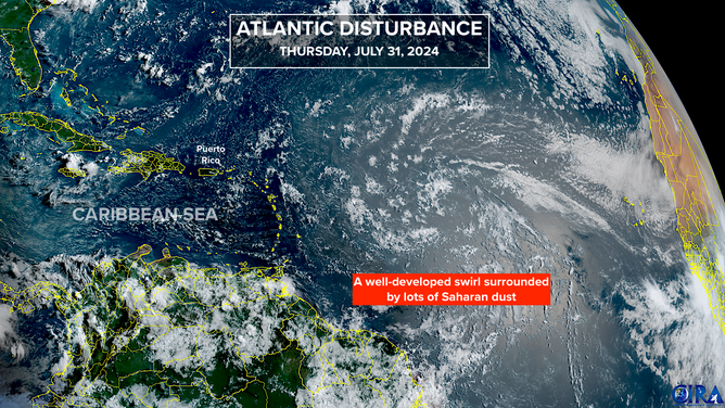
A couple of days ago, the long-range models indicated that the disturbance might develop if it tracks farther north. The odds were never conclusive, but that doesn’t seem to be a concern now.
The National Hurricane Center is not expecting any tropical development for the next week.
The overall weather pattern looks to become more conducive to tropical development around the middle of August. Something could form before then, of course, but there’s no indication of a strong system developing in the current long-range computer forecasts.
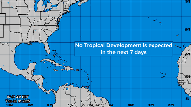
Each robust tropical disturbance that moves off Africa should moisten the tropical belt, which will make the next disturbance’s trek easier. Based on the various long-range forecasts, that process looks to be slow as the dust and dry air that have dominated the Atlantic hang on.
So for now, the typical July lull continues.
In the Pacific
(NHC / Bryan Norcross / NOAA)
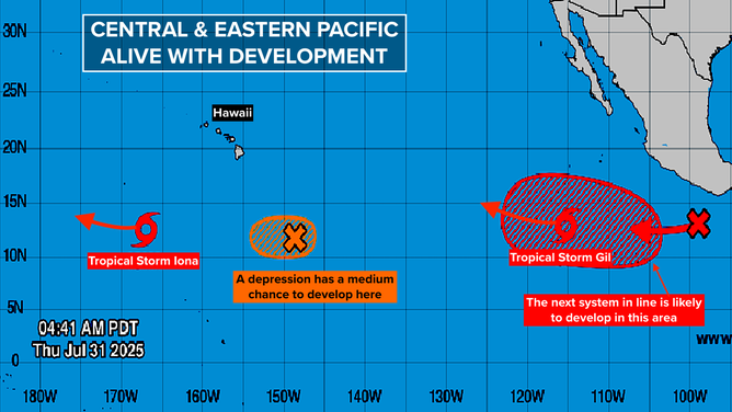
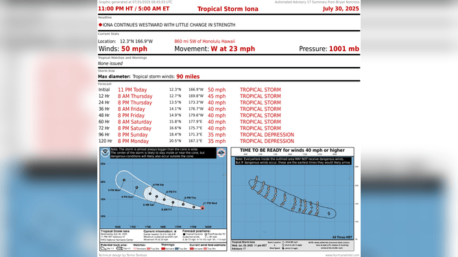
The Eastern and Central Pacific continue to be alive with activity. The only system of a little interest is Tropical Storm Gil, which formed well southwest of Mexico. It’s forecast to eventually turn into Hurricane Gil and head in the general direction of Hawaii.
Gil will be tracking over coolish water long before it gets to the islands, which will limit its intensity. It’s something to watch, but there’s no concern that a strong storm will impact the island chain.
(NHC / Bryan Norcross / NOAA)
Source link
editor's pick
latest video
Sports News To You
Subscribe to receive daily sports scores, hot takes, and breaking news!