Thursday flash flood threat grows along I-95 corridor in Northeast

Rain and storms are making their way through the Midwest, impacting cities in Missouri and Illinois tonight before pushing to the Northeast and Mid-Atlantic on Thursday. Washington, D.C., Philadelphia and Baltimore are currently under a 3/4 risk while New York City is under a 2/4 risk.
NEW YORK– As the heat wave wanes in the Northeast and a cooldown is ushered in on Thursday, heavy rain could bring in flash flooding for cities along Interstate 95.
The rain and storms are bringing a flood risk to the Midwest, with areas like Chicago and Detroit as well as parts of Missouri on alert for flooding through Wednesday night.

Warning boxes are color coded as: Severe Thunderstorm Warnings in yellow, Tornado Warnings in red, Tornado Warnings with confirmed tornado in purple, Flash Flood Warnings in green, and Flash Flood Emergencies in pink.
(FOX Weather)
On Thursday, the flooding threat moves east into the Mid-Atlantic and Northeast. NOAA’s Weather Prediction Center issued a level 3 out of 4 flash flooding risk for 23 million in the area, including those living in Washington, D.C., Baltimore and Philadelphia.
So far in July, portions of the Northeast have been under a level 3 flash flood risk six times.
Central and northern New Jersey are also under a moderate risk of flooding. New York City is under a level 2 out of 4 flood risk.
KNOW YOUR FLOOD TERMINOLOGY: WHAT FLOOD WATCHES, WARNINGS AND EMERGENCIES REALLY MEAN

Flash flood threat for the Northeast for Thursday.
(FOX Weather)
The rain and storms will focus along a strong but slow-moving cold front, with additional strength caused by the development of an area of low pressure along the front.
The FOX Forecast Center has high confidence that several inches of rain will fall over the area where storms linger the longest, with some totals reaching 3-5 inches.

Flood Watches are in effect for all of Connecticut and New Jersey, as well as southern New York, Washington, D.C. and Baltimore and eastern Pennsylvania.
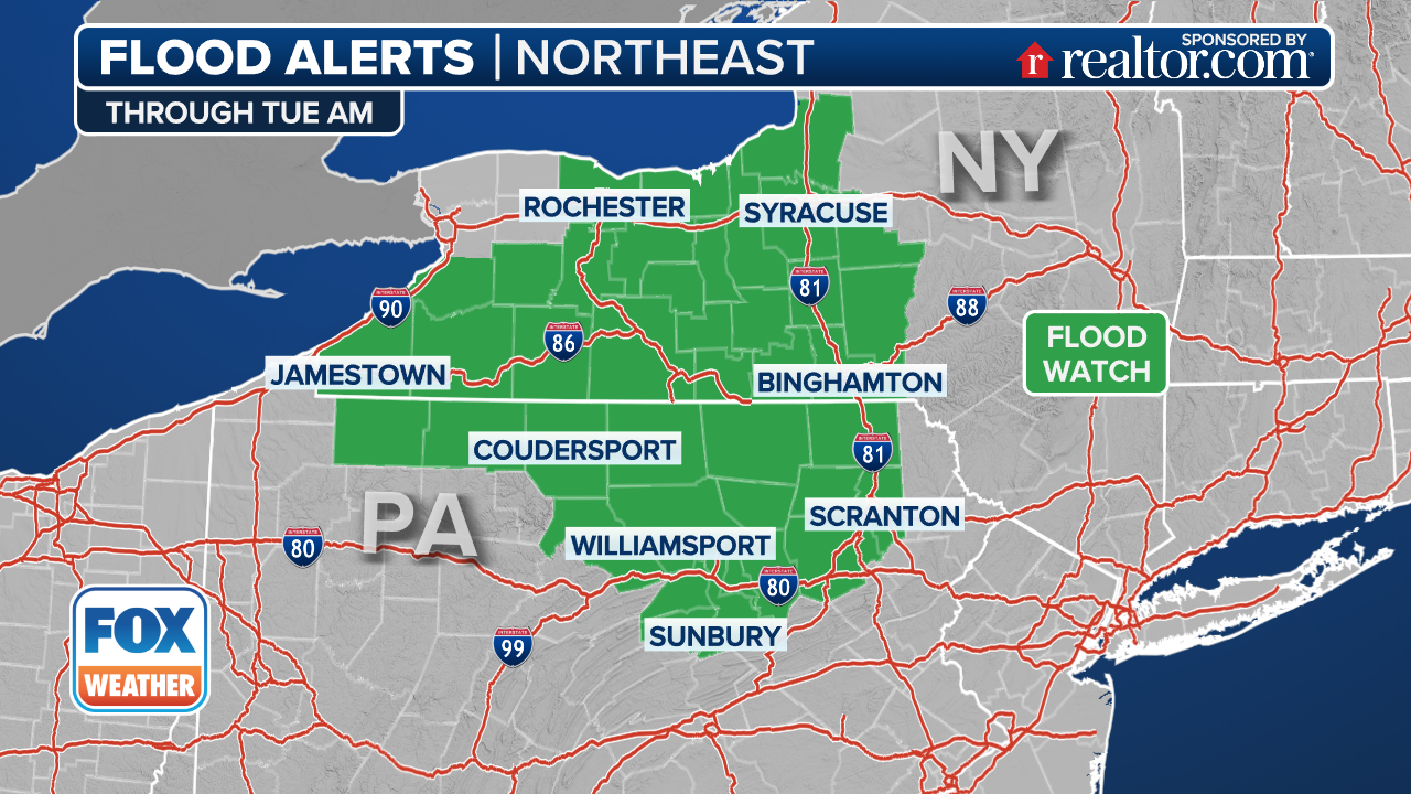
(FOX Weather)
Rain will linger into Friday morning, but a return to drier weather returns for the weekend.
Source link
editor's pick
latest video
Sports News To You
Subscribe to receive daily sports scores, hot takes, and breaking news!