Building heat dome, ring of fire storms headline weather pattern this week
A building heat dome is expanding out of the southern states and into the heart of the country. However, it’s not just the heat. A familiar summertime pattern will take shape around the edges of the dome, often referred to as the ring of fire.
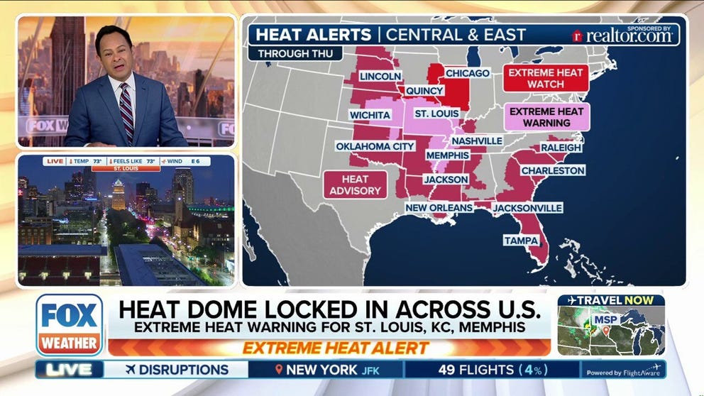
KANSAS CITY, Mo. – The big weather story this week is a large area of high pressure building over the central U.S., often called a “heat dome,” the FOX Forecast Center warns.
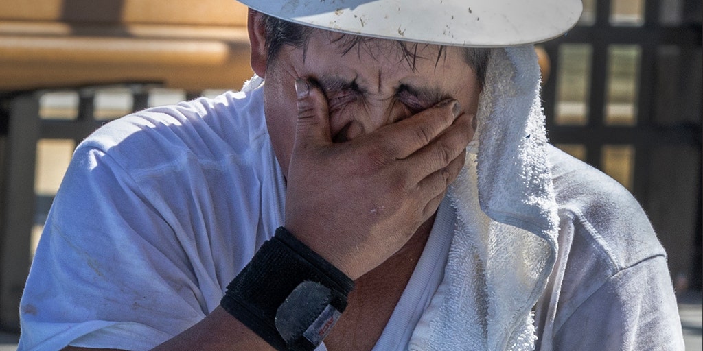
FILE – A man wipes the sweat away after working on the spray deck at the Vietnam Veterans Swimming and Wading Pool on June 24, 2025.
(Stan Grossfeld/The Boston Globe via Getty Images)
These systems trap heat beneath them and lead to stretches of very hot, dry weather. While this particular heat dome won’t likely break any records, it will push temperatures into the upper 90s for a huge portion of the country.
(FOX Weather)
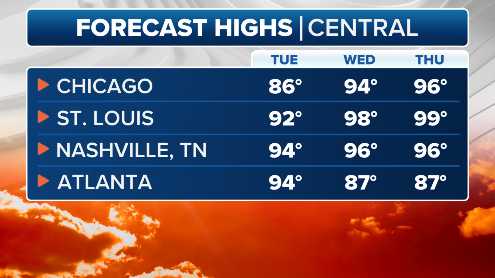
What will make it feel even worse is the humidity. With dew points running high, the heat index, or “feels-like” temperature, will soar above 100 degrees in many major cities, like St. Louis, Kansas City and Oklahoma City. Some areas could even feel closer to 110-115 degrees.
The high humidity makes it harder for your body to cool off through sweating, which is why it feels so much hotter than the thermometer shows, the FOX Forecast Center added.
(FOX Weather)
Underneath the heat dome, the weather will stay mostly dry. Texas, for example, will continue drying out this week, which is a welcome break after recent flooding in places like Kerrville.
However, not every part of the country will be dry. The moisture being blocked from rising straight up into the heat dome is instead getting pushed around it.
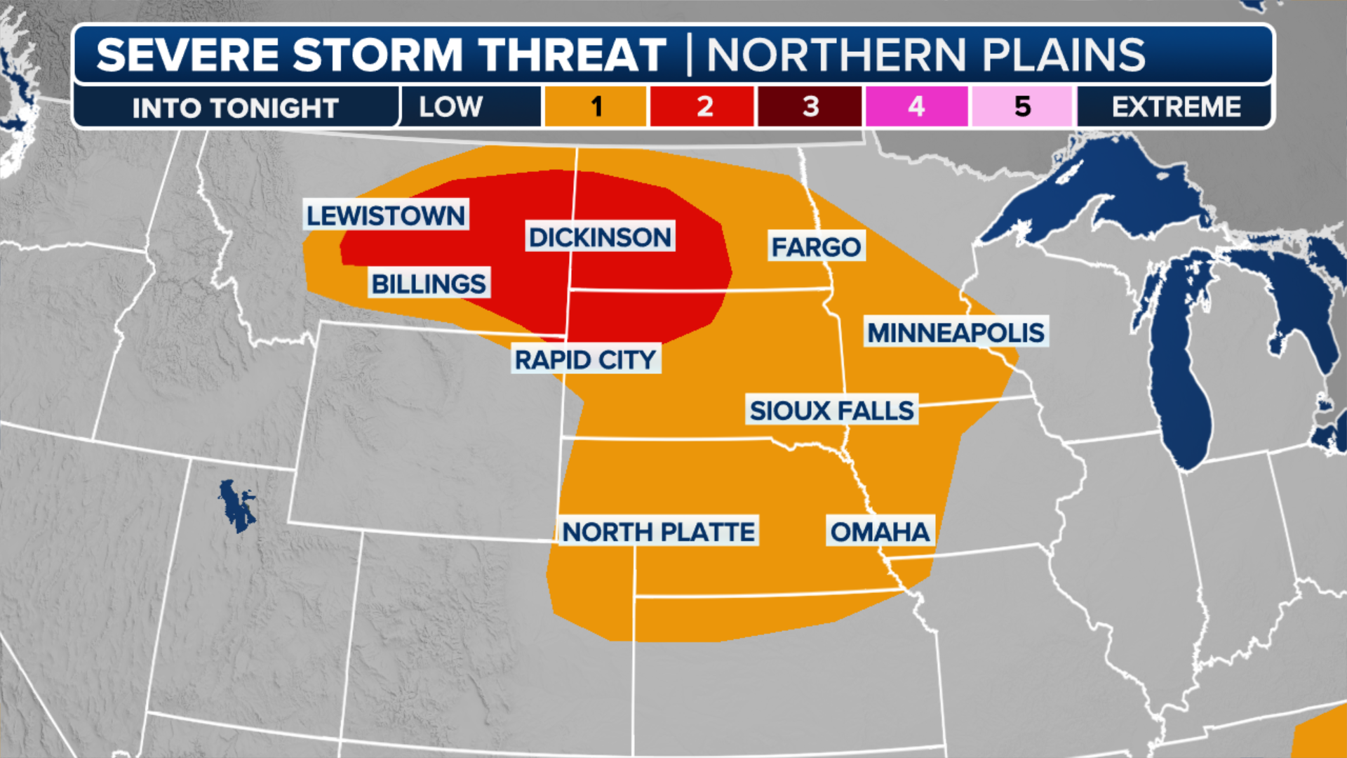
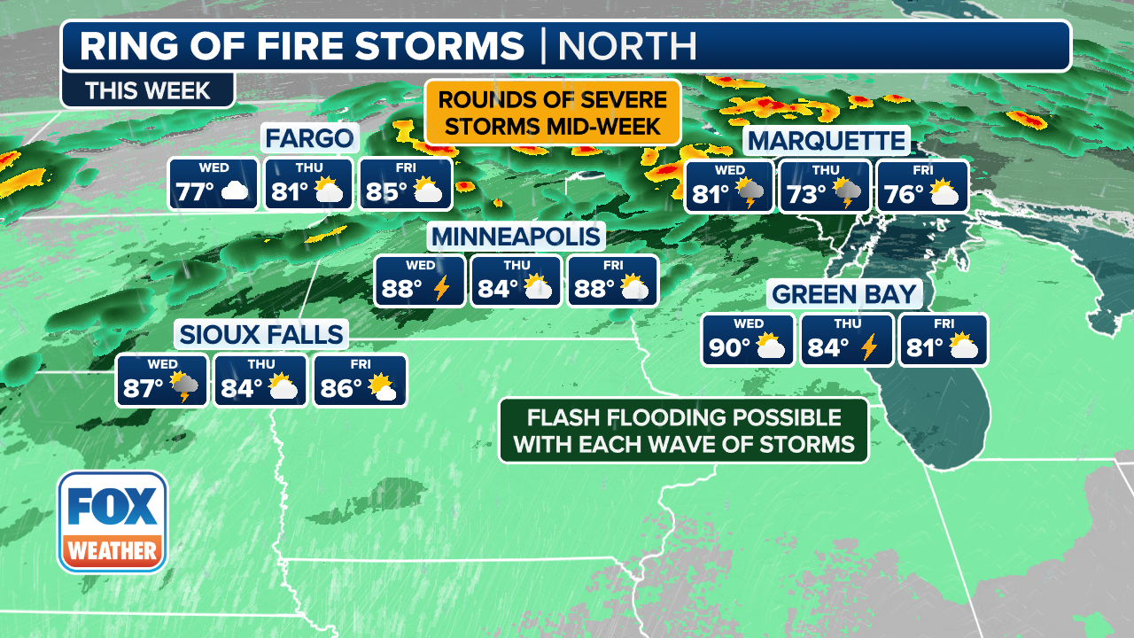
This creates a setup where storms fire up along the northern and eastern edges of the dome. These “ring of fire” storms are powered by daytime heat and plenty of unstable air. They can bring damaging winds, large hail and heavy rain. If storms stall over the same area, flash flooding can happen, especially in places that have recently flooded.
(FOX Weather)
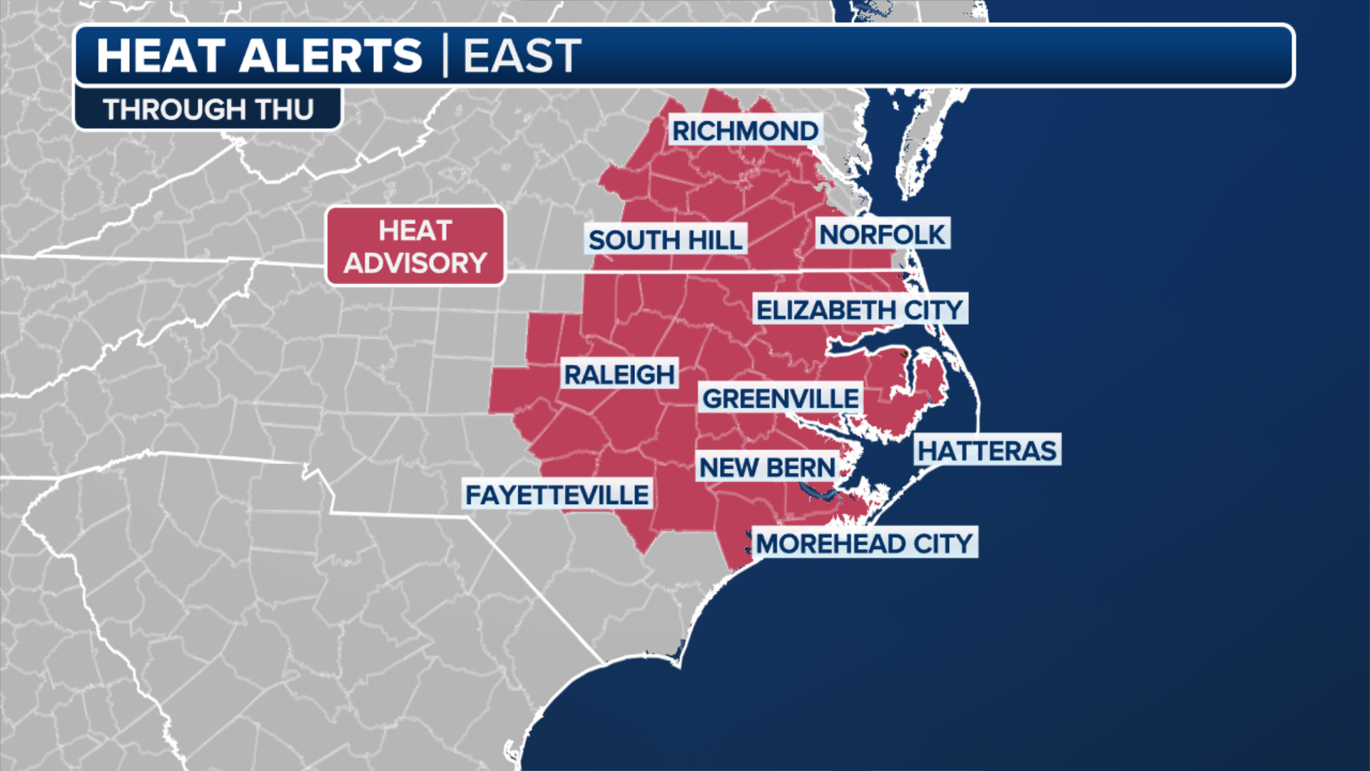
To start the week, the areas most at risk for storms and flash flooding include the Midwest, the Tennessee River Valley and parts of the Southeast.
(FOX Weather)
The heat dome will slowly shift eastward during the week, which may briefly reduce the storm chances in some places, but the heat isn’t going anywhere.
By the weekend, the dome may start to rebuild farther west into the Rockies and Plains, continuing this summer pattern well into next week.
Source link
editor's pick
latest video
Sports News To You
Subscribe to receive daily sports scores, hot takes, and breaking news!