Bryan Norcross: Atlantic tropical disturbance Invest 94L showing some signs of life

FOX Weather is your Hurricane HQ.
(FOX Weather)
Updated at 9 a.m. ET Monday, July 21, 2025
The disturbance we’ve been following in the tropical Atlantic has perked up a little. The National Hurricane Center has tagged it Invest 94L. They still have its odds of developing into at least a tropical depression in the low category, but they’ve increased them slightly.
The atmospheric conditions immediately ahead are reasonably conducive to tropical development. They would be very conducive if there wasn’t so much dry air nearby. Saharan dust blankets the ocean just north of and around the disturbance.
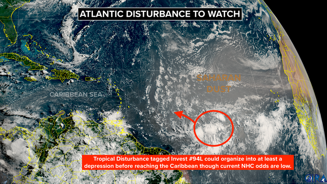
The disturbance we’ve been following in the tropical Atlantic has perked up a little. The National Hurricane Center has tagged it Invest 94L.
(NOAA)
The system’s best chance of developing is tonight. By late tomorrow, as the disturbance is approaching the Caribbean, the upper-level winds will increase, and no further development is expected.
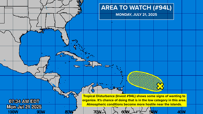
The system’s best chance of developing is tonight.
(NOAA)
Most likely, the system will move across the islands as a gusty moisture surge late tomorrow or Wednesday. In the meantime, however, it could organize enough to be designated a tropical depression, with a very slight chance that it briefly becomes Tropical Storm Dexter.
Invest 94L is the first in a series of robust disturbances moving off Africa. Saharan dust plumes are still thick, but gaps are allowing some thunderstorms to develop within the clusters of moisture. On average, Saharan dust begins to wane late in July, although its schedule varies year to year.
Some long-range computer forecasts indicate that the next systems in the wave train moving across the Atlantic will be a little more robust than we have seen. This is expected, of course, with August right around the corner.
In the Gulf
Just like the week before last, a front is going to die out across North Florida in a few days. A low-pressure area is forecast to develop along the old front and track west across the northern Gulf.
There is no sign of tropical development at this point, but we’ll keep an eye on it. In any case, it will bring another round of heavy rain to the Gulf Coast and the Florida Peninsula.
On average, this part of July is slow in the tropics, so nothing unusual is going on. The traditional start of the busy part of the hurricane season is Aug. 20. There’s no reason to think that this season isn’t going to ramp up on schedule.
Source link
editor's pick
latest video
Sports News To You
Subscribe to receive daily sports scores, hot takes, and breaking news!