Exclusive analysis from Bryan Norcross: Latest on Atlantic hurricane season

FOX Weather Hurricane Specialist Bryan Norcross is in New Orleans at the National Hurricane Conference and joined FOX Weather on Tuesday morning to discuss Hurricane Katrina and its impact 20 years after the catastrophic and historic storm devastated the region.
This hurricane season feels very unusual so far, but it’s really not. Today, June 20, is on average the date when the first storm is named. But that means that half of the time naming starts later.
In the famous hurricane year of 2004 when four major storms hit Florida, the first named storm appeared in the tropics on August 9. That was Tropical Storm Bonnie, which formed in the southern Gulf and came ashore in the Florida panhandle as a 50-mph tropical storm on August 12.
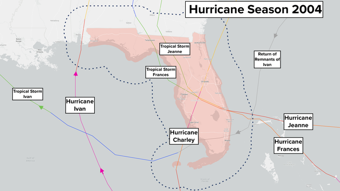
Look back at Hurricane Season 2024 in the Atlantic
(FOX Weather)
A system that became Hurricane Alex actually formed on August 1, but that was farther north, and out of the tropics. Alex ended up brushing North Carolina before it moved out to sea.
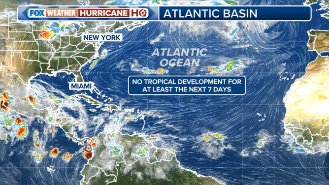
The important takeaway is that what happens in June says nothing about how busy the heart of the hurricane season is going to be.
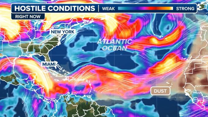
For the next week, and probably into at least early July, the conditions across the tropics are expected to remain hostile to any tropical development. A band of strong upper-level winds, stretches from Texas across the Caribbean to Africa, while strong impulses of Saharan dust flow from Africa toward the Caribbean. In addition, the waters between the Caribbean and the African coast are much cooler than they were the last two years. They are closer to the long-term average.
There’s no reason to think that the tropical ocean is not going to warm up and support hurricane development, and that the weather pattern won’t evolve and become conducive to the formation of tropical storms and hurricanes as we head toward August. So while it’s nice that we’re not scrambling to talk about developing storms in the June, we still have to be ready for the hurricane season to come.
The eastern Pacific Ocean has been on fire, so to speak, with record activity already in the books. Five storms have already been named, and another has a decent chance of developing next week. That one will be called Flossie if it comes together.
Strong high pressure over the Atlantic has directed the tropical disturbances into the Pacific, where they have found an extremely fertile atmosphere and ocean. This basic weather pattern is forecast to continue for the rest of the month, at least.
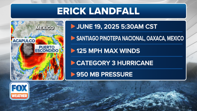
This graphic shows the information regarding Hurricane Erick’s landfall in Mexico on Thursday, June 19, 2025.
(FOX Weather)
Hurricane Erick came ashore yesterday morning as a Category 3 between Acapulco and Puerto Escondido on the southern Mexican coast. Thankfully, it was weakening at landfall. It peaked as a 145-mph Category 4 just offshore. The threat of flooding and landslides in mountain areas will continue until the rainfall drains to the ocean.
But for everybody watching the Atlantic, Caribbean, and Gulf, enjoy the June snooze.
Source link
editor's pick
latest video
Sports News To You
Subscribe to receive daily sports scores, hot takes, and breaking news!