Minneapolis threatened by hail, tornadoes as Midwest faces days of severe storms

Severe thunderstorms are expected Monday across parts of eastern South Dakota, Minnesota and Wisconsin. Storms could bring large hail, damaging winds and possibly a few tornadoes.
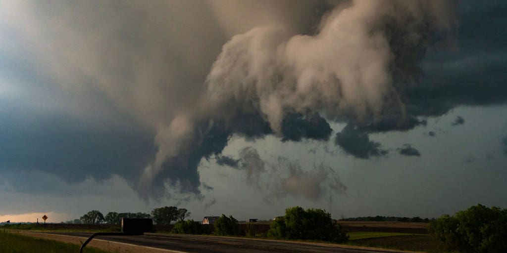
The Midwest is facing a prolonged period of severe weather through Wednesday, with the FOX Forecast Center warning of multiple rounds of intense thunderstorms capable of producing tornadoes, very large hail, damaging winds and significant flash flooding.
The threat extends from Minnesota, including Minneapolis–St. Paul, southwestward to the central Plains and eastward into parts of the Great Lakes region.
“It’s going to be busy,” FOX Weather Meteorologist Britta Merwin said Monday morning. “We got today’s problems, then we have Tuesday and Wednesday on the docket, all with very similar potentials for every mode of severe weather.”
After Monday, the days of severe weather will continue with an increased threat of flash flooding.
Severe storms Monday target Twin Cities
Severe thunderstorms developed across the Dakotas early Monday morning and were expected to continue charging east toward northern Minnesota, the FOX Forecast Center said. These early storms produced intense wind gusts across Montana. Hurricane-force wind gusts of up to 81 mph were reported in Miles City, Montana, on Sunday night.
DOWNLOAD THE FREE FOX WEATHER APP

(FOX Weather)
Later Monday, more widespread storms are expected to form along a front stretching from southeastern South Dakota into southern Minnesota, where warm and humid air will make the atmosphere more unstable.
These storms may become quite intense, especially in parts of southeastern South Dakota, northeastern Nebraska and southern Minnesota, where the conditions will be most favorable for large hail and damaging wind gusts, the FOX Forecast Center said. Some of the stronger storms could bring a risk for tornadoes, especially from eastern South Dakota into central Minnesota.
A Level 3 out of 5 threat for severe storms is in place, and it does encompass the Twin Cities of Minneapolis-St. Paul. The hail threat is the main driver of the increased threat level.

(FOX Weather)
“There is a ton of energy here later today,” warned FOX Weather Meteorologist Craig Herrera, noting the slow-moving nature of these systems, combined with heavy rainfall, also raises concerns about flash flooding.
(FOX Weather)
Humidity levels are exceptionally high for this time of year, with Minneapolis experiencing dew points around 70 degrees, making it feel more like Jackson, Mississippi. This added moisture will fuel the development of intense storms.
Storms will continue charging east into Wisconsin during the evening, with the severe weather threat gradually shifting along with them. To the south across Nebraska, another line of storms is expected to develop late and bring strong, damaging wind gusts across the central part of the state.
Severe weather continues Tuesday as flash flood risk rises
While the lingering mess from Monday’s storms will start the day, a significant reload is anticipated for Tuesday, particularly across the central Plains and into the Missouri Valley, which is farther south than the threat zone on Monday.
The threats of large hail and damaging winds will be in place once again, especially in areas like southern Kansas, northwestern Missouri and southeastern Iowa.
Central Kansas will be the major concern, with a Level 3 out of 5 alert for severe weather, carrying the highest potential for tornadoes and large hailstones exceeding 2 inches in diameter.

(FOX Weather)
Wednesday brings severe storms to Chicago, Detroit and St. Louis
By Wednesday, the severe weather will continue its eastward progression, moving through the Upper Midwest and now into the lower Missouri and mid-Mississippi valleys, the FOX Forecast Center said. While the early morning on Wednesday might see the tail end of Tuesday’s storms, new development is expected in the afternoon and evening.
Places like Detroit, Chicago, Indianapolis and St. Louis are under a Level 2 out of 5 threat for severe storms. Large hail and damaging wind gusts will be the main concerns.

(FOX Weather)
Again, high humidity will be a factor, contributing to the intensity of the storms and their rainfall output. An expected 2-3 inches of rain across Iowa and Wisconsin could exacerbate existing flood concerns in areas that have already experienced flooding in recent weeks.
Source link
editor's pick
latest video
Sports News To You
Subscribe to receive daily sports scores, hot takes, and breaking news!