As Alvin degenerates, remnants could bring unusual pre-monsoon rainfall over Desert Southwest
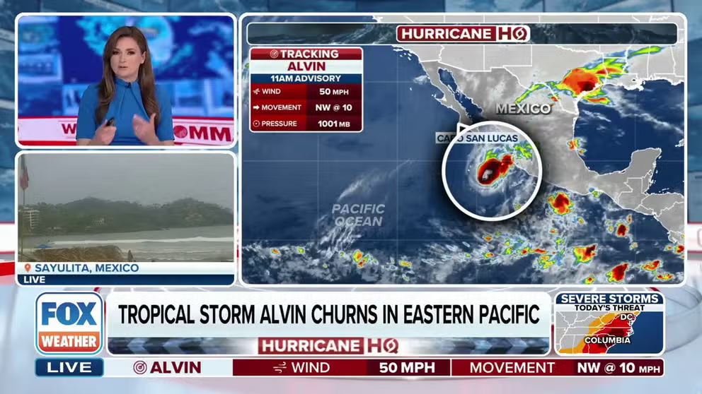
Tropical Storm Alvin is unraveling quickly as it churns large swells towards portions of western mainland Mexico and the Baja California Peninsula, bringing an increased risk of life-threatening rip currents.
PHOENIX – A surge of moisture, due in part to the placement of an upper-level low and the tropical moisture field from the Northern Hemisphere’s first tropical cyclone of the year, will lead to increased rain chances across the Southwest over the next several days.
Moisture from the remnants of Tropical Storm Alvin will help increase humidity levels and eventually rain chances for cities such as Phoenix and Yuma, and potentially as far west as Las Vegas and Palm Springs, California.
Forecast models generally expect less than 0.25 inches of rainfall across southeast California, while parts of Arizona could see totals closer to half an inch.
Forecasters caution that rainfall amounts could be enhanced over higher terrain, where totals of up to an inch are possible, potentially leading to minor flooding in downstream areas.
An isolated thunderstorm cannot be ruled out, but the main impact will come from the unusual rainfall for this time of year.
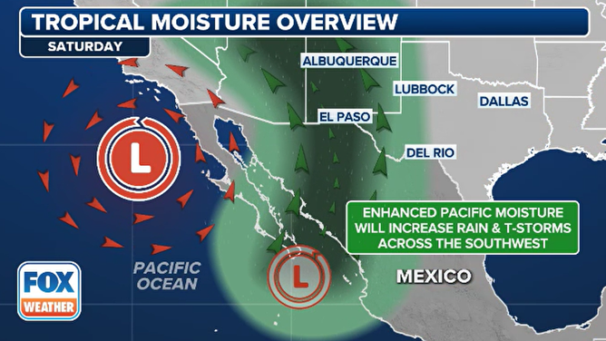
Expected moisture over the Southwest
(FOX Weather)
SOUTHWEST MONSOON SEASON IS HERE: WHAT YOU NEED TO KNOW
According to National Weather Service historical data, Phoenix Sky Harbor Airport has only recorded measurable rainfall 38 times during the last week of May and the first week of June.
Rainfall during this period is even rarer in Yuma, which has only recorded measurable rain 11 times during the same window since the late 1800s.
The FOX Forecast Center stresses that the increased humidity and rainfall are not part of the annual monsoon, which typically begins around June 15 and lasts through Sept. 30.

(FOX Weather)
Cities in the Southwest accumulate roughly half of their annual precipitation during the months of June, July, August and September, though amounts can vary significantly.
The monsoon pattern is closely linked to the status of the El Niño-Southern Oscillation, or what is commonly called the ENSO.
During La Niña events, the monsoon signal is typically more expansive and leads to heavier rainfall, while El Niño conditions can delay the start of the rainy season.
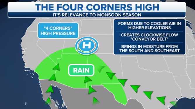
Shown on the map is the typical weather pattern that dominates during much of the North American monsoon season.
(FOX Weather)
The unusual early-season rainfall will bring major benefits, including reduced wildfire potential and cooler temperatures.
Highs during the second half of the weekend are expected to only reach the lower 90s, a significant drop from recent temperatures reaching 100-110 degrees.
Any relief is expected to be temporary, as a building heat dome late next week and into the second week of June could bring the hottest temperatures of the year so far.
Source link
editor's pick
latest video
Sports News To You
Subscribe to receive daily sports scores, hot takes, and breaking news!